Mandayona geodata
Mandayona (Castille-La Mancha) is a seat of a third-order administrative division; located in Spain in Europe/Madrid (GMT+2) time zone. With population of 394 people, there are 4157 cities with bigger population in this country. Compared to other cities in Spain, 52.6% of cities are located further ↑North; 58.1% of cities are located further ←West and 77.8% of cities have lower elevation than Mandayona. Note1
Administrative division(s):
- Level 1: Castille-La Mancha
- Level 2: Provincia de Guadalajara
- Level 3: Mandayona


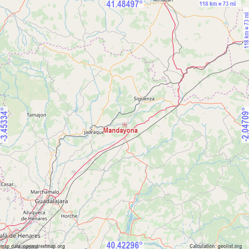
Mandayona GPS coordinates[2]
40° 57' 21.96" North, 2° 45' 0.756" West
| Map corner | latitude | longitude |
|---|---|---|
| Upper-left | 41.48497°, | -3.45334° |
| Center: | 40.9561°, | -2.75021° |
| Lower-right: | 40.42296°, | -2.04709° |
| Map W x H: | 118.1×118.1 km | = 73.4×73.4mi |
| max Lat: | 43.74134° ⇑52.6% North |
| Mandayona: | 40.9561° |
| min Lat: | ⇓47.4% South 27.64134° |
| min Long | Mandayona | max Long |
| -18.00367° | -2.75021° | 4.2899° |
| W 58.1%⇐ | ⇒41.9% E |
Elevation
Elevation of Mandayona is 877 m = 2877 ft, and this is 279 m = 915 ft above average elevation for this country.
| Max E: |
1682 m = 5518 ft | 22.2% |
| Mandayona | 877 m 2877 ft | |
| Avg. | 598 m = 1962 ft | |
Min E: |
0 m = 0 ft | 77.8% |
See also: Spain elevation on elevation.city.
Geographical zone
Mandayona is located in North temperate zone (between Tropic of Cancer and the Arctic Circle). Distance of this Northern Tropic circle is 1948 km =1210.4 mi to South.| Distance of | km | miles | from Mandayona |
|---|---|---|---|
| North Pole | 5453.2 | 3388.5 | to North |
| Arctic Circle | 2847.3 | 1769.2 | to North |
| Tropic Cancer | 1948 | 1210.4 | to South |
| Equator | 4553.9 | 2829.7 | to South |


Nearby cities:
15 places around Mandayona: (largest is in red/bold)
• Alaminos
10.6 km =6.6 mi,  168°
168°
• Algora
7 km =4.3 mi,  83°
83°
• Almadrones
6.5 km =4 mi,  198°
198°
• Argecilla
10.2 km =6.3 mi,  215°
215°
• Baides
6 km =3.7 mi,  338°
338°
• Bujalaro
11.4 km =7.1 mi,  259°
259°
• Castejón de Henares
3.7 km =2.3 mi,  236°
236°
• Cendejas de la Torre
8.8 km =5.5 mi,  286°
286°
• Cogollor
12 km =7.5 mi,  177°
177°
• Huérmeces del Cerro
11.5 km =7.1 mi, 339°
• Matillas
7.3 km =4.5 mi, 259°
• Mirabueno
2.5 km =1.6 mi,  120°
120°
• Torremocha del Campo
11.3 km =7 mi, 77°
• Viana de Jadraque
7.9 km =4.9 mi,  348°
348°
• Villaseca de Henares
4 km =2.5 mi,  277°
277°
Sources, notices
• [Note1] Compared only with cities in Spain existing in our database
• [Src1] Map data: © OpenStreetMap contributors (CC-BY-SA)
• [Src2] Other city data from geonames.org with taken over terms of usage.
• [Src3] Geographical zone / Annual Mean Temperature by Robert A. Rohde @ Wikipedia
