Llívia geodata
Llívia (Catalonia) is a seat of a third-order administrative division; located in Spain in Europe/Madrid (GMT+2) time zone. In our database, there are 6762 cities with bigger population. Compared to other cities in Spain, 86.4% of cities are located further ↓South; 93.4% of cities are located further ←West and 97.3% of cities have lower elevation than Llívia. Note1


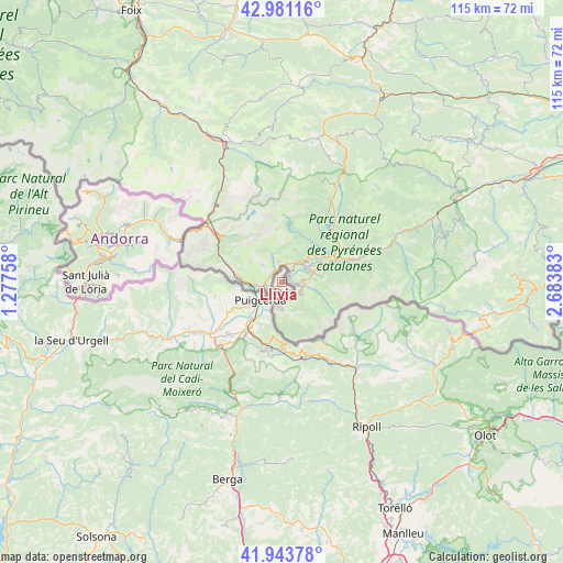
Llívia GPS coordinates[2]
42° 27' 52.632" North, 1° 58' 50.52" East
| Map corner | latitude | longitude |
|---|---|---|
| Upper-left | 42.98116°, | 1.27758° |
| Center: | 42.46462°, | 1.9807° |
| Lower-right: | 41.94378°, | 2.68383° |
| Map W x H: | 115.3×115.3 km | = 71.6×71.6mi |
| max Lat: | 43.74134° ⇑13.6% North |
| Llívia: | 42.46462° |
| min Lat: | ⇓86.4% South 27.64134° |
| min Long | Llívia | max Long |
| -18.00367° | 1.9807° | 4.2899° |
| W 93.4%⇐ | ⇒6.6% E |
Elevation
Elevation of Llívia is 1217 m = 3993 ft, and this is 619 m = 2031 ft above average elevation for this country.
| Max E: |
1682 m = 5518 ft | 2.7% |
| Llívia | 1217 m 3993 ft | |
| Avg. | 598 m = 1962 ft | |
Min E: |
0 m = 0 ft | 97.3% |
See also: Spain elevation on elevation.city.
Geographical zone
Llívia is located in North temperate zone (between Tropic of Cancer and the Arctic Circle). Distance of this Northern Tropic circle is 2115.7 km =1314.6 mi to South.| Distance of | km | miles | from Llívia |
|---|---|---|---|
| North Pole | 5285.4 | 3284.2 | to North |
| Arctic Circle | 2679.6 | 1665 | to North |
| Tropic Cancer | 2115.7 | 1314.6 | to South |
| Equator | 4721.6 | 2933.9 | to South |


Nearby cities:
15 places around Llívia: (largest is in red/bold)
• Alp
12.8 km =8 mi,  216°
216°
• Bellver de Cerdanya
19.5 km =12.1 mi,  236°
236°
• Bolvir
9.8 km =6.1 mi, 237°
• Das
14.6 km =9.1 mi, 218°
• Ger
12.6 km =7.8 mi, 241°
• Guils de Cerdanya
8.5 km =5.3 mi,  256°
256°
• Isòvol
16.5 km =10.3 mi,  234°
234°
• Meranges
16 km =9.9 mi, 262°
• Planoles
19.1 km =11.9 mi,  149°
149°
• Puigcerdà
5.7 km =3.5 mi, 229°
• Ribes de Freser
23.5 km =14.6 mi,  139°
139°
• Riu de Cerdanya
18.3 km =11.4 mi, 223°
• Toses
16.2 km =10.1 mi,  169°
169°
• Urús
16.4 km =10.2 mi, 219°
• Éller
16.4 km =10.2 mi,  250°
250°
Sources, notices
• [Note1] Compared only with cities in Spain existing in our database
• [Src1] Map data: © OpenStreetMap contributors (CC-BY-SA)
• [Src2] Other city data from geonames.org with taken over terms of usage.
• [Src3] Geographical zone / Annual Mean Temperature by Robert A. Rohde @ Wikipedia
