Jorcas geodata
Jorcas (Aragon) is a seat of a third-order administrative division; located in Spain in Europe/Madrid (GMT+2) time zone. With population of 38 people, there are 6589 cities with bigger population in this country. Compared to other cities in Spain, 61.1% of cities are located further ↑North; 79.4% of cities are located further ←West and 98.9% of cities have lower elevation than Jorcas. Note1


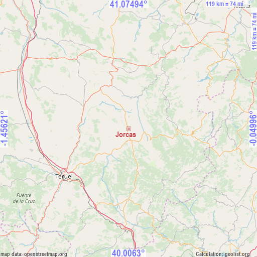
Jorcas GPS coordinates[2]
40° 32' 33.9" North, 0° 45' 11.088" West
| Map corner | latitude | longitude |
|---|---|---|
| Upper-left | 41.07494°, | -1.45621° |
| Center: | 40.54275°, | -0.75308° |
| Lower-right: | 40.0063°, | -0.04996° |
| Map W x H: | 118.8×118.8 km | = 73.8×73.8mi |
| max Lat: | 43.74134° ⇑61.1% North |
| Jorcas: | 40.54275° |
| min Lat: | ⇓38.9% South 27.64134° |
| min Long | Jorcas | max Long |
| -18.00367° | -0.75308° | 4.2899° |
| W 79.4%⇐ | ⇒20.6% E |
Elevation
Elevation of Jorcas is 1340 m = 4396 ft, and this is 742 m = 2434 ft above average elevation for this country.
| Max E: |
1682 m = 5518 ft | 1.1% |
| Jorcas | 1340 m 4396 ft | |
| Avg. | 598 m = 1962 ft | |
Min E: |
0 m = 0 ft | 98.9% |
See also: Spain elevation on elevation.city.
Geographical zone
Jorcas is located in North temperate zone (between Tropic of Cancer and the Arctic Circle). Distance of this Northern Tropic circle is 1902 km =1181.8 mi to South.| Distance of | km | miles | from Jorcas |
|---|---|---|---|
| North Pole | 5499.1 | 3417 | to North |
| Arctic Circle | 2893.2 | 1797.8 | to North |
| Tropic Cancer | 1902 | 1181.8 | to South |
| Equator | 4507.9 | 2801.1 | to South |


Nearby cities:
15 places around Jorcas: (largest is in red/bold)
• Ababuj
4.7 km =2.9 mi,  278°
278°
• Aguilar del Alfambra
6.4 km =4 mi,  325°
325°
• Aliaga
15.2 km =9.4 mi,  16°
16°
• Allepuz
6 km =3.7 mi,  156°
156°
• Camarillas
7.7 km =4.8 mi,  359°
359°
• Cañada de Benatanduz
18.7 km =11.6 mi,  77°
77°
• Cedrillas
14.4 km =8.9 mi,  215°
215°
• Escorihuela
18.4 km =11.4 mi,  270°
270°
• Galve
16.6 km =10.3 mi,  319°
319°
• Gúdar
11.6 km =7.2 mi,  166°
166°
• Hinojosa de Jarque
16.7 km =10.4 mi,  350°
350°
• Jarque de la Val
18.2 km =11.3 mi, 347°
• Monteagudo del Castillo
11 km =6.8 mi,  209°
209°
• Pitarque
17.9 km =11.1 mi,  48°
48°
• Villarroya de los Pinares
7.3 km =4.5 mi,  101°
101°
Sources, notices
• [Note1] Compared only with cities in Spain existing in our database
• [Src1] Map data: © OpenStreetMap contributors (CC-BY-SA)
• [Src2] Other city data from geonames.org with taken over terms of usage.
• [Src3] Geographical zone / Annual Mean Temperature by Robert A. Rohde @ Wikipedia
