Guardo geodata
Guardo (Castille and León) is a seat of a third-order administrative division; located in Spain in Europe/Madrid (GMT+2) time zone. With population of 7,920 people, there are 946 cities with bigger population in this country. Compared to other cities in Spain, 92.6% of cities are located further ↓South; 70.4% of cities are located further →East and 93.1% of cities have lower elevation than Guardo. Note1
Administrative division(s):
- Level 1: Castille and León
- Level 2: Provincia de Palencia
- Level 3: Guardo


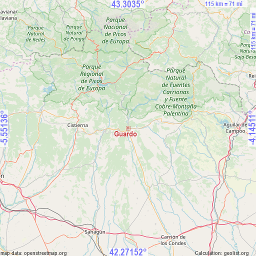
Guardo GPS coordinates[2]
42° 47' 22.776" North, 4° 50' 53.628" West
| Map corner | latitude | longitude |
|---|---|---|
| Upper-left | 43.3035°, | -5.55136° |
| Center: | 42.78966°, | -4.84823° |
| Lower-right: | 42.27152°, | -4.14511° |
| Map W x H: | 114.7×114.7 km | = 71.3×71.3mi |
| max Lat: | 43.74134° ⇑7.4% North |
| Guardo: | 42.78966° |
| min Lat: | ⇓92.6% South 27.64134° |
| min Long | Guardo | max Long |
| -18.00367° | -4.84823° | 4.2899° |
| W 29.6%⇐ | ⇒70.4% E |
Elevation
Elevation of Guardo is 1094 m = 3589 ft, and this is 496 m = 1627 ft above average elevation for this country.
| Max E: |
1682 m = 5518 ft | 6.9% |
| Guardo | 1094 m 3589 ft | |
| Avg. | 598 m = 1962 ft | |
Min E: |
0 m = 0 ft | 93.1% |
See also: Spain elevation on elevation.city.
Geographical zone
Guardo is located in North temperate zone (between Tropic of Cancer and the Arctic Circle). Distance of this Northern Tropic circle is 2151.8 km =1337.1 mi to South.| Distance of | km | miles | from Guardo |
|---|---|---|---|
| North Pole | 5249.3 | 3261.8 | to North |
| Arctic Circle | 2643.4 | 1642.5 | to North |
| Tropic Cancer | 2151.8 | 1337.1 | to South |
| Equator | 4757.8 | 2956.4 | to South |


Nearby cities:
15 places around Guardo: (largest is in red/bold)
• Castrejón de la Peña
20.4 km =12.7 mi,  84°
84°
• Cebanico
16.2 km =10.1 mi,  243°
243°
• Congosto de Valdavia
19.3 km =12 mi,  115°
115°
• Fresno del Río
12.3 km =7.6 mi,  168°
168°
• Mantinos
4.2 km =2.6 mi, 173°
• Pino del Río
16.4 km =10.2 mi, 168°
• Prado de la Guzpeña
14.5 km =9 mi,  267°
267°
• Prioro
15 km =9.3 mi,  321°
321°
• Respenda de la Peña
13.6 km =8.5 mi,  101°
101°
• Santibáñez de la Peña
9.9 km =6.2 mi, 77°
• Tabanera de Valdavia
20.2 km =12.6 mi,  141°
141°
• Triollo
20.3 km =12.6 mi,  42°
42°
• Valderrueda
8.6 km =5.3 mi,  289°
289°
• Velilla del Río Carrión
4.1 km =2.5 mi,  2°
2°
• Villalba de Guardo
7.8 km =4.8 mi,  164°
164°
Sources, notices
• [Note1] Compared only with cities in Spain existing in our database
• [Src1] Map data: © OpenStreetMap contributors (CC-BY-SA)
• [Src2] Other city data from geonames.org with taken over terms of usage.
• [Src3] Geographical zone / Annual Mean Temperature by Robert A. Rohde @ Wikipedia
