el Parc i la Llacuna del Poblenou geodata
el Parc i la Llacuna del Poblenou (Catalonia) is a section of populated place; located in Spain in Europe/Madrid (GMT+2) time zone. With population of 14,950 people, there are 622 cities with bigger population in this country. Compared to other cities in Spain, 57.7% of cities are located further ↓South; 95.2% of cities are located further ←West and 97.6% of cities have higher elevation than el Parc i la Llacuna del Poblenou. Note1
Administrative division(s):
- Level 1: Catalonia
- Level 2: Província de Barcelona
- Level 3: Barcelona
- Level 4: Sant Martí
Current local time in el Parc i la Llacuna del Poblenou:
10:51 PM, ThursdayDifference from your time zone: hours


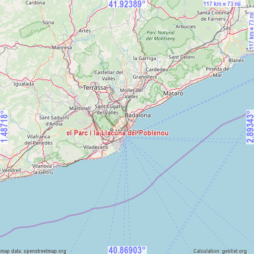
el Parc i la Llacuna del Poblenou GPS coordinates[2]
41° 23' 54.96" North, 2° 11' 25.08" East
| Map corner | latitude | longitude |
|---|---|---|
| Upper-left | 41.92389°, | 1.48718° |
| Center: | 41.3986°, | 2.1903° |
| Lower-right: | 40.86903°, | 2.89343° |
| Map W x H: | 117.3×117.3 km | = 72.9×72.9mi |
| max Lat: | 43.74134° ⇑42.3% North |
| el Parc i la Llacuna del Poblenou: | 41.3986° |
| min Lat: | ⇓57.7% South 27.64134° |
| min Long | el Parc i la Ll | max Long |
| -18.00367° | 2.1903° | 4.2899° |
| W 95.2%⇐ | ⇒4.8% E |
Elevation
Elevation of el Parc i la Llacuna del Poblenou is 13 m = 43 ft, and this is 585 m = 1919 ft below average elevation for this country.
| Max E: |
1682 m = 5518 ft | 97.6% |
| Avg. | 598 m = 1962 ft | |
| el Parc i la Llacuna del Poblenou | 13 m = 43 ft | |
Min E: |
0 m = 0 ft | 2.4% |
See also: Spain elevation on elevation.city.
Geographical zone
el Parc i la Llacuna del Poblenou is located in North temperate zone (between Tropic of Cancer and the Arctic Circle). Distance of this Northern Tropic circle is 1997.2 km =1241 mi to South.| Distance of | km | miles | from el Parc i la Llacuna del Poblenou |
|---|---|---|---|
| North Pole | 5404 | 3357.9 | to North |
| Arctic Circle | 2798.1 | 1738.7 | to North |
| Tropic Cancer | 1997.2 | 1241 | to South |
| Equator | 4603.1 | 2860.2 | to South |


Nearby cities:
15 places around el Parc i la Llacuna del Poblenou: (largest is in red/bold)
• Barri Gòtic
2 km =1.2 mi,  215°
215°
• Diagonal Mar
2.4 km =1.5 mi,  61°
61°
• Dreta de l'Eixample
2 km =1.2 mi,  261°
261°
• Fort Pienc
1 km =0.6 mi,  243°
243°
• Navas
2.2 km =1.4 mi,  350°
350°
• Provenals del Poblenou
1.7 km =1.1 mi,  36°
36°
• Sagrada Família
1.5 km =0.9 mi,  293°
293°
• Sant Martí
2.3 km =1.4 mi,  19°
19°
• Sant Pere, Santa Caterina i La Ribera
1.7 km =1.1 mi,  205°
205°
• el Camp d'en Grassot i Gràcia Nova
2.3 km =1.4 mi, 292°
• el Camp de l'Arpa del Clot
1.6 km =1 mi,  336°
336°
• el Clot
1.3 km =0.8 mi,  0°
0°
• el Poblenou
1.3 km =0.8 mi, 62°
• la Barceloneta
2.1 km =1.3 mi,  181°
181°
• la Vila Olímpica del Poblenou
1 km =0.6 mi,  148°
148°
Sources, notices
• [Note1] Compared only with cities in Spain existing in our database
• [Src1] Map data: © OpenStreetMap contributors (CC-BY-SA)
• [Src2] Other city data from geonames.org with taken over terms of usage.
• [Src3] Geographical zone / Annual Mean Temperature by Robert A. Rohde @ Wikipedia
