Saint-Barnabé geodata
Saint-Barnabé (Provence-Alpes-Côte d'Azur) is a section of populated place; located in France in Europe/Paris (GMT+2) time zone. With population of 12,070 people, there are 795 cities with bigger population in this country. Compared to other cities in France, 95.7% of cities are located further ↑North; 82.1% of cities are located further ←West and 69.7% of cities have higher elevation than Saint-Barnabé. Note1
Administrative division(s):
- Level 1: Provence-Alpes-Côte d'Azur
- Level 2: Département des Bouches-du-Rhône
- Level 3: Arrondissement de Marseille
- Level 4: Marseille


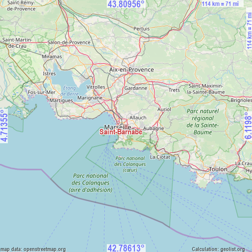
Saint-Barnabé GPS coordinates[2]
43° 18' 0" North, 5° 25' 0.012" East
| Map corner | latitude | longitude |
|---|---|---|
| Upper-left | 43.80956°, | 4.71355° |
| Center: | 43.3°, | 5.41667° |
| Lower-right: | 42.78613°, | 6.1198° |
| Map W x H: | 113.8×113.8 km | = 70.7×70.7mi |
| max Lat: | 51.07786° ⇑95.7% North |
| Saint-Barnabé: | 43.3° |
| min Lat: | ⇓4.3% South 41.3874° |
| min Long | Saint-Barnabé | max Long |
| -5.08615° | 5.41667° | 9.52242° |
| W 82.1%⇐ | ⇒17.9% E |
Elevation
Elevation of Saint-Barnabé is 79 m = 259 ft, and this is 114.7 m = 376 ft below average elevation for this country.
| Max E: |
2333 m = 7654 ft | 69.7% |
| Avg. | 193.7 m = 635 ft | |
| Saint-Barnabé | 79 m = 259 ft | |
Min E: |
-1 m = -3 ft | 30.3% |
See also: France elevation on elevation.city.
Geographical zone
Saint-Barnabé is located in North temperate zone (between Tropic of Cancer and the Arctic Circle). Distance of this Northern Tropic circle is 2208.6 km =1372.4 mi to South.| Distance of | km | miles | from Saint-Barnabé |
|---|---|---|---|
| North Pole | 5192.6 | 3226.5 | to North |
| Arctic Circle | 2586.7 | 1607.3 | to North |
| Tropic Cancer | 2208.6 | 1372.4 | to South |
| Equator | 4814.5 | 2991.6 | to South |


Nearby cities:
15 places around Saint-Barnabé: (largest is in red/bold)
• Baille
2 km =1.2 mi,  227°
227°
• Cinq Avenues
1.6 km =1 mi,  285°
285°
• La Blancarde
0.9 km =0.6 mi,  273°
273°
• La Conception
2.1 km =1.3 mi,  243°
243°
• La Fourragère
1.3 km =0.8 mi,  70°
70°
• La Timone
1.3 km =0.8 mi,  187°
187°
• Le Camas
1.9 km =1.2 mi,  252°
252°
• Les Chartreux
1.6 km =1 mi,  322°
322°
• Marseille 04
1.3 km =0.8 mi,  280°
280°
• Marseille 05
1.4 km =0.9 mi, 249°
• Marseille 11
2 km =1.2 mi,  120°
120°
• Marseille 12
1.6 km =1 mi,  105°
105°
• Montolivet
2 km =1.2 mi,  16°
16°
• Saint-Jean du Désert
0.8 km =0.5 mi,  153°
153°
• Saint-Pierre
1.1 km =0.7 mi,  224°
224°
Sources, notices
• [Note1] Compared only with cities in France existing in our database
• [Src1] Map data: © OpenStreetMap contributors (CC-BY-SA)
• [Src2] Other city data from geonames.org with taken over terms of usage.
• [Src3] Geographical zone / Annual Mean Temperature by Robert A. Rohde @ Wikipedia
