Oloron-Sainte-Marie geodata
Oloron-Sainte-Marie (Nouvelle-Aquitaine) is a seat of a third-order administrative division; located in France in Europe/Paris (GMT+2) time zone. With population of 12,611 people, there are 752 cities with bigger population in this country. Compared to other cities in France, 97.2% of cities are located further ↑North; 84.6% of cities are located further →East and 70.4% of cities have lower elevation than Oloron-Sainte-Marie. Note1
Administrative division(s):
- Level 1: Nouvelle-Aquitaine
- Level 2: Département des Pyrénées-Atlantiques
- Level 3: Oloron-Sainte-Marie
- Level 4: Oloron-Sainte-Marie


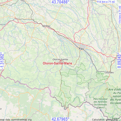
Oloron-Sainte-Marie GPS coordinates[2]
43° 11' 39.876" North, 0° 36' 38.484" West
| Map corner | latitude | longitude |
|---|---|---|
| Upper-left | 43.70486°, | -1.31382° |
| Center: | 43.19441°, | -0.61069° |
| Lower-right: | 42.67965°, | 0.09243° |
| Map W x H: | 114×114 km | = 70.8×70.8mi |
| max Lat: | 51.07786° ⇑97.2% North |
| Oloron-Sainte-Marie: | 43.19441° |
| min Lat: | ⇓2.8% South 41.3874° |
| min Long | Oloron-Sainte-M | max Long |
| -5.08615° | -0.61069° | 9.52242° |
| W 15.4%⇐ | ⇒84.6% E |
Elevation
Elevation of Oloron-Sainte-Marie is 221 m = 725 ft, and this is 27.3 m = 90 ft above average elevation for this country.
| Max E: |
2333 m = 7654 ft | 29.6% |
| Oloron-Sainte-Marie | 221 m 725 ft | |
| Avg. | 193.7 m = 635 ft | |
Min E: |
-1 m = -3 ft | 70.4% |
See also: France elevation on elevation.city.
Geographical zone
Oloron-Sainte-Marie is located in North temperate zone (between Tropic of Cancer and the Arctic Circle). Distance of this Northern Tropic circle is 2196.8 km =1365 mi to South.| Distance of | km | miles | from Oloron-Sainte-Marie |
|---|---|---|---|
| North Pole | 5204.3 | 3233.8 | to North |
| Arctic Circle | 2598.4 | 1614.6 | to North |
| Tropic Cancer | 2196.8 | 1365 | to South |
| Equator | 4802.8 | 2984.3 | to South |


Nearby cities:
15 places around Oloron-Sainte-Marie: (largest is in red/bold)
• Agnos
3.1 km =1.9 mi,  188°
188°
• Aramits
12.2 km =7.6 mi,  224°
224°
• Arette
13.6 km =8.5 mi, 219°
• Asasp-Arros
8.7 km =5.4 mi,  183°
183°
• Aubertin
13.1 km =8.1 mi,  52°
52°
• Barcus
12.9 km =8 mi,  267°
267°
• Esquiule
8.6 km =5.3 mi, 274°
• Eysus
7.1 km =4.4 mi,  161°
161°
• Goès
2.3 km =1.4 mi,  74°
74°
• Gurmençon
4.5 km =2.8 mi, 163°
• Lasseube
11.2 km =7 mi, 67°
• Ledeuix
2.5 km =1.6 mi,  348°
348°
• Lucq-de-Béarn
12.6 km =7.8 mi,  338°
338°
• Moumour
5.2 km =3.2 mi,  298°
298°
• Ogeu-les-Bains
10.2 km =6.3 mi,  118°
118°
Sources, notices
• [Note1] Compared only with cities in France existing in our database
• [Src1] Map data: © OpenStreetMap contributors (CC-BY-SA)
• [Src2] Other city data from geonames.org with taken over terms of usage.
• [Src3] Geographical zone / Annual Mean Temperature by Robert A. Rohde @ Wikipedia
