Morteau geodata
Morteau (Bourgogne-Franche-Comté) is a populated place; located in France in Europe/Paris (GMT+2) time zone. With population of 6,343 people, there are 1562 cities with bigger population in this country. Compared to other cities in France, 54.7% of cities are located further ↑North; 92.4% of cities are located further ←West and 97.5% of cities have lower elevation than Morteau. Note1
Administrative division(s):
- Level 1: Bourgogne-Franche-Comté
- Level 2: Doubs
- Level 3: Arrondissement de Pontarlier
- Level 4: Morteau


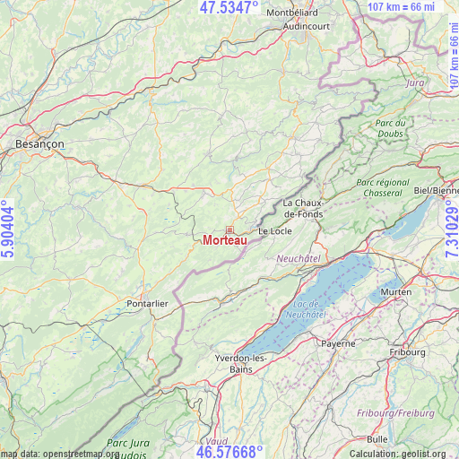
Morteau GPS coordinates[2]
47° 3' 28.224" North, 6° 36' 25.776" East
| Map corner | latitude | longitude |
|---|---|---|
| Upper-left | 47.5347°, | 5.90404° |
| Center: | 47.05784°, | 6.60716° |
| Lower-right: | 46.57668°, | 7.31029° |
| Map W x H: | 106.5×106.5 km | = 66.2×66.2mi |
| max Lat: | 51.07786° ⇑54.7% North |
| Morteau: | 47.05784° |
| min Lat: | ⇓45.3% South 41.3874° |
| min Long | Morteau | max Long |
| -5.08615° | 6.60716° | 9.52242° |
| W 92.4%⇐ | ⇒7.6% E |
Elevation
Elevation of Morteau is 769 m = 2523 ft, and this is 575.3 m = 1887 ft above average elevation for this country.
| Max E: |
2333 m = 7654 ft | 2.5% |
| Morteau | 769 m 2523 ft | |
| Avg. | 193.7 m = 635 ft | |
Min E: |
-1 m = -3 ft | 97.5% |
See also: France elevation on elevation.city.
Geographical zone
Morteau is located in North temperate zone (between Tropic of Cancer and the Arctic Circle). Distance of this North polar circle is 2168.8 km =1347.6 mi to North.| Distance of | km | miles | from Morteau |
|---|---|---|---|
| North Pole | 4774.7 | 2966.9 | to North |
| Arctic Circle | 2168.8 | 1347.6 | to North |
| Tropic Cancer | 2626.4 | 1632 | to South |
| Equator | 5232.3 | 3251.2 | to South |


Nearby cities:
15 places around Morteau: (largest is in red/bold)
• Arc-sous-Cicon
17.2 km =10.7 mi,  267°
267°
• Avoudrey
15.8 km =9.8 mi,  303°
303°
• Bonnétage
17.3 km =10.7 mi,  23°
23°
• Flangebouche
13.8 km =8.6 mi,  311°
311°
• Gilley
9.5 km =5.9 mi,  262°
262°
• Guyans-Vennes
11.3 km =7 mi,  346°
346°
• La Longeville
12.1 km =7.5 mi,  238°
238°
• Le Russey
14.7 km =9.1 mi,  38°
38°
• Les Combes
4.4 km =2.7 mi,  282°
282°
• Les Fins
2.8 km =1.7 mi, 38°
• Les Gras
8.4 km =5.2 mi,  214°
214°
• Lièvremont
17 km =10.6 mi,  234°
234°
• Montlebon
2.3 km =1.4 mi,  172°
172°
• Orchamps-Vennes
10.2 km =6.3 mi,  322°
322°
• Villers-le-Lac
4.6 km =2.9 mi,  82°
82°
Sources, notices
• [Note1] Compared only with cities in France existing in our database
• [Src1] Map data: © OpenStreetMap contributors (CC-BY-SA)
• [Src2] Other city data from geonames.org with taken over terms of usage.
• [Src3] Geographical zone / Annual Mean Temperature by Robert A. Rohde @ Wikipedia
