Les Hôpitaux-Neufs geodata
Les Hôpitaux-Neufs (Bourgogne-Franche-Comté) is a populated place; located in France in Europe/Paris (GMT+2) time zone. With population of 532 people, there are 14567 cities with bigger population in this country. Compared to other cities in France, 57.4% of cities are located further ↑North; 90.9% of cities are located further ←West and 99.1% of cities have lower elevation than Les Hôpitaux-Neufs. Note1
Administrative division(s):
- Level 1: Bourgogne-Franche-Comté
- Level 2: Doubs
- Level 3: Arrondissement de Pontarlier
- Level 4: Les Hôpitaux-Neufs


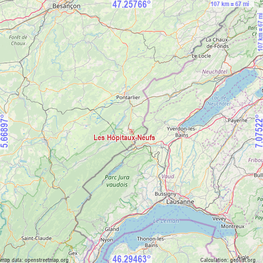
Les Hôpitaux-Neufs GPS coordinates[2]
46° 46' 41.88" North, 6° 22' 19.56" East
| Map corner | latitude | longitude |
|---|---|---|
| Upper-left | 47.25766°, | 5.66897° |
| Center: | 46.7783°, | 6.3721° |
| Lower-right: | 46.29463°, | 7.07522° |
| Map W x H: | 107.1×107.1 km | = 66.5×66.5mi |
| max Lat: | 51.07786° ⇑57.4% North |
| Les Hôpitaux-Neufs: | 46.7783° |
| min Lat: | ⇓42.6% South 41.3874° |
| min Long | Les Hôpitaux-N | max Long |
| -5.08615° | 6.3721° | 9.52242° |
| W 90.9%⇐ | ⇒9.1% E |
Elevation
Elevation of Les Hôpitaux-Neufs is 998 m = 3274 ft, and this is 804.3 m = 2639 ft above average elevation for this country.
| Max E: |
2333 m = 7654 ft | 0.90000000000001% |
| Les Hôpitaux-Neufs | 998 m 3274 ft | |
| Avg. | 193.7 m = 635 ft | |
Min E: |
-1 m = -3 ft | 99.1% |
See also: France elevation on elevation.city.
Geographical zone
Les Hôpitaux-Neufs is located in North temperate zone (between Tropic of Cancer and the Arctic Circle). Distance of this North polar circle is 2199.9 km =1367 mi to North.| Distance of | km | miles | from Les Hôpitaux-Neufs |
|---|---|---|---|
| North Pole | 4805.8 | 2986.2 | to North |
| Arctic Circle | 2199.9 | 1367 | to North |
| Tropic Cancer | 2595.3 | 1612.6 | to South |
| Equator | 5201.3 | 3231.9 | to South |


Nearby cities:
15 places around Les Hôpitaux-Neufs: (largest is in red/bold)
• Chaffois
16.7 km =10.4 mi,  333°
333°
• Granges-Narboz
12.2 km =7.6 mi,  340°
340°
• Houtaud
16 km =9.9 mi, 343°
• Jougne
2.1 km =1.3 mi,  144°
144°
• La Cluse-et-Mijoux
11.7 km =7.3 mi,  4°
4°
• La Rivière-Drugeon
15.4 km =9.6 mi,  310°
310°
• Labergement-Sainte-Marie
7.1 km =4.4 mi,  266°
266°
• Les Fourgs
6.6 km =4.1 mi,  18°
18°
• Malbuisson
5.6 km =3.5 mi,  292°
292°
• Montperreux
5.7 km =3.5 mi, 336°
• Mouthe
16.1 km =10 mi,  240°
240°
• Métabief
1.7 km =1.1 mi, 235°
• Oye-et-Pallet
8.5 km =5.3 mi, 338°
• Pontarlier
14 km =8.7 mi,  354°
354°
• Vaux-et-Chantegrue
10.2 km =6.3 mi, 289°
Sources, notices
• [Note1] Compared only with cities in France existing in our database
• [Src1] Map data: © OpenStreetMap contributors (CC-BY-SA)
• [Src2] Other city data from geonames.org with taken over terms of usage.
• [Src3] Geographical zone / Annual Mean Temperature by Robert A. Rohde @ Wikipedia
