Lantriac geodata
Lantriac (Auvergne-Rhône-Alpes) is a populated place; located in France in Europe/Paris (GMT+2) time zone. With population of 1,680 people, there are 5577 cities with bigger population in this country. Compared to other cities in France, 79.6% of cities are located further ↑North; 67.9% of cities are located further ←West and 97.2% of cities have lower elevation than Lantriac. Note1
Administrative division(s):
- Level 1: Auvergne-Rhône-Alpes
- Level 2: Haute-Loire
- Level 3: Arrondissement du Puy-en-Velay
- Level 4: Lantriac


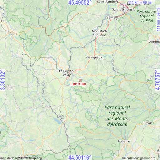
Lantriac GPS coordinates[2]
45° 0' 1.8" North, 4° 0' 15.984" East
| Map corner | latitude | longitude |
|---|---|---|
| Upper-left | 45.49552°, | 3.30132° |
| Center: | 45.0005°, | 4.00444° |
| Lower-right: | 44.50116°, | 4.70757° |
| Map W x H: | 110.6×110.6 km | = 68.7×68.7mi |
| max Lat: | 51.07786° ⇑79.6% North |
| Lantriac: | 45.0005° |
| min Lat: | ⇓20.4% South 41.3874° |
| min Long | Lantriac | max Long |
| -5.08615° | 4.00444° | 9.52242° |
| W 67.9%⇐ | ⇒32.1% E |
Elevation
Elevation of Lantriac is 737 m = 2418 ft, and this is 543.3 m = 1782 ft above average elevation for this country.
| Max E: |
2333 m = 7654 ft | 2.8% |
| Lantriac | 737 m 2418 ft | |
| Avg. | 193.7 m = 635 ft | |
Min E: |
-1 m = -3 ft | 97.2% |
See also: France elevation on elevation.city.
Geographical zone
Lantriac is located in North temperate zone (between Tropic of Cancer and the Arctic Circle). Distance of this North polar circle is 2397.6 km =1489.8 mi to North.| Distance of | km | miles | from Lantriac |
|---|---|---|---|
| North Pole | 5003.5 | 3109 | to North |
| Arctic Circle | 2397.6 | 1489.8 | to North |
| Tropic Cancer | 2397.7 | 1489.9 | to South |
| Equator | 5003.6 | 3109.1 | to South |


Nearby cities:
15 places around Lantriac: (largest is in red/bold)
• Arsac-en-Velay
4.9 km =3 mi,  257°
257°
• Blavozy
6.6 km =4.1 mi,  343°
343°
• Brives-Charensac
7.9 km =4.9 mi,  311°
311°
• Coubon
6.8 km =4.2 mi,  267°
267°
• Cussac-sur-Loire
9.6 km =6 mi, 261°
• Laussonne
5.1 km =3.2 mi,  132°
132°
• Le Monastier-sur-Gazeille
7.5 km =4.7 mi,  182°
182°
• Le Puy-en-Velay
10.5 km =6.5 mi,  297°
297°
• Saint-Germain-Laprade
5 km =3.1 mi,  327°
327°
• Saint-Hostien
8.7 km =5.4 mi,  22°
22°
• Saint-Julien-Chapteuil
5.9 km =3.7 mi,  49°
49°
• Saint-Pierre-Eynac
5.6 km =3.5 mi, 24°
• Saint-Étienne-Lardeyrol
7.9 km =4.9 mi,  358°
358°
• Solignac-sur-Loire
10 km =6.2 mi,  248°
248°
• Vals-près-le-Puy
10.5 km =6.5 mi,  289°
289°
Sources, notices
• [Note1] Compared only with cities in France existing in our database
• [Src1] Map data: © OpenStreetMap contributors (CC-BY-SA)
• [Src2] Other city data from geonames.org with taken over terms of usage.
• [Src3] Geographical zone / Annual Mean Temperature by Robert A. Rohde @ Wikipedia
