Éveux geodata
Éveux (Auvergne-Rhône-Alpes) is a populated place; located in France in Europe/Paris (GMT+2) time zone. With population of 853 people, there are 10054 cities with bigger population in this country. Compared to other cities in France, 68.9% of cities are located further ↑North; 73% of cities are located further ←West and 83.4% of cities have lower elevation than Éveux. Note1
Administrative division(s):
- Level 1: Auvergne-Rhône-Alpes
- Level 2: Département du Rhône
- Level 3: Arrondissement de Villefranche-sur-Saône
- Level 4: Éveux


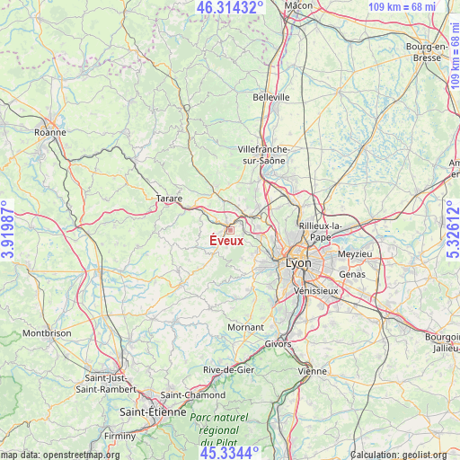
Éveux GPS coordinates[2]
45° 49' 35.472" North, 4° 37' 22.8" East
| Map corner | latitude | longitude |
|---|---|---|
| Upper-left | 46.31432°, | 3.91987° |
| Center: | 45.82652°, | 4.623° |
| Lower-right: | 45.3344°, | 5.32612° |
| Map W x H: | 109×109 km | = 67.7×67.7mi |
| max Lat: | 51.07786° ⇑68.9% North |
| Éveux: | 45.82652° |
| min Lat: | ⇓31.1% South 41.3874° |
| min Long | Éveux | max Long |
| -5.08615° | 4.623° | 9.52242° |
| W 73%⇐ | ⇒27% E |
Elevation
Elevation of Éveux is 327 m = 1073 ft, and this is 133.3 m = 437 ft above average elevation for this country.
| Max E: |
2333 m = 7654 ft | 16.6% |
| Éveux | 327 m 1073 ft | |
| Avg. | 193.7 m = 635 ft | |
Min E: |
-1 m = -3 ft | 83.4% |
See also: France elevation on elevation.city.
Geographical zone
Éveux is located in North temperate zone (between Tropic of Cancer and the Arctic Circle). Distance of this North polar circle is 2305.7 km =1432.7 mi to North.| Distance of | km | miles | from Éveux |
|---|---|---|---|
| North Pole | 4911.6 | 3051.9 | to North |
| Arctic Circle | 2305.7 | 1432.7 | to North |
| Tropic Cancer | 2489.5 | 1546.9 | to South |
| Equator | 5095.4 | 3166.1 | to South |


Nearby cities:
15 places around Éveux: (largest is in red/bold)
• Bully
4.1 km =2.5 mi,  311°
311°
• Chessy
6.7 km =4.2 mi,  0°
0°
• Chevinay
6.4 km =4 mi,  190°
190°
• Châtillon
5.9 km =3.7 mi,  17°
17°
• Dommartin
6.9 km =4.3 mi,  82°
82°
• La Tour-de-Salvagny
7.4 km =4.6 mi,  101°
101°
• Lentilly
3.2 km =2 mi,  105°
105°
• Lozanne
5.6 km =3.5 mi,  52°
52°
• Nuelles
2.6 km =1.6 mi, 0°
• Pollionnay
7.5 km =4.7 mi,  156°
156°
• Sain-Bel
2.7 km =1.7 mi,  226°
226°
• Saint-Germain-Nuelles
3 km =1.9 mi,  343°
343°
• Saint-Pierre-la-Palud
4.1 km =2.5 mi, 192°
• Savigny
4 km =2.5 mi,  252°
252°
• Sourcieux-les-Mines
2.3 km =1.4 mi,  180°
180°
Sources, notices
• [Note1] Compared only with cities in France existing in our database
• [Src1] Map data: © OpenStreetMap contributors (CC-BY-SA)
• [Src2] Other city data from geonames.org with taken over terms of usage.
• [Src3] Geographical zone / Annual Mean Temperature by Robert A. Rohde @ Wikipedia
