Delme geodata
Delme (Grand Est) is a populated place; located in France in Europe/Paris (GMT+2) time zone. With population of 754 people, there are 11124 cities with bigger population in this country. Compared to other cities in France, 77.4% of cities are located further ↓South; 91% of cities are located further ←West and 71.8% of cities have lower elevation than Delme. Note1
Administrative division(s):
- Level 1: Grand Est
- Level 2: Moselle
- Level 3: Arrondissement de Sarrebourg-Château-Salins
- Level 4: Delme


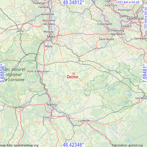
Delme GPS coordinates[2]
48° 53' 16.548" North, 6° 23' 30.048" East
| Map corner | latitude | longitude |
|---|---|---|
| Upper-left | 49.34812°, | 5.68856° |
| Center: | 48.88793°, | 6.39168° |
| Lower-right: | 48.42346°, | 7.09481° |
| Map W x H: | 102.8×102.8 km | = 63.9×63.9mi |
| max Lat: | 51.07786° ⇑22.6% North |
| Delme: | 48.88793° |
| min Lat: | ⇓77.4% South 41.3874° |
| min Long | Delme | max Long |
| -5.08615° | 6.39168° | 9.52242° |
| W 91%⇐ | ⇒9% E |
Elevation
Elevation of Delme is 229 m = 751 ft, and this is 35.3 m = 116 ft above average elevation for this country.
| Max E: |
2333 m = 7654 ft | 28.2% |
| Delme | 229 m 751 ft | |
| Avg. | 193.7 m = 635 ft | |
Min E: |
-1 m = -3 ft | 71.8% |
See also: France elevation on elevation.city.
Geographical zone
Delme is located in North temperate zone (between Tropic of Cancer and the Arctic Circle). Distance of this North polar circle is 1965.3 km =1221.2 mi to North.| Distance of | km | miles | from Delme |
|---|---|---|---|
| North Pole | 4571.2 | 2840.4 | to North |
| Arctic Circle | 1965.3 | 1221.2 | to North |
| Tropic Cancer | 2829.9 | 1758.4 | to South |
| Equator | 5435.8 | 3377.6 | to South |


Nearby cities:
15 places around Delme: (largest is in red/bold)
• Belleau
16.5 km =10.3 mi,  247°
247°
• Bouxières-aux-Chênes
16 km =9.9 mi,  216°
216°
• Brin-sur-Seille
12.3 km =7.6 mi,  192°
192°
• Béchy
10.9 km =6.8 mi,  355°
355°
• Champenoux
16.5 km =10.3 mi, 191°
• Château-Salins
11.8 km =7.3 mi,  130°
130°
• Faulx
17.8 km =11.1 mi,  233°
233°
• Jeandelaincourt
11.8 km =7.3 mi, 245°
• Leyr
13.1 km =8.1 mi, 225°
• Louvigny
17.2 km =10.7 mi,  298°
298°
• Moncel-sur-Seille
13.9 km =8.6 mi,  171°
171°
• Nomeny
12.1 km =7.5 mi,  270°
270°
• Rémilly
14 km =8.7 mi,  0°
0°
• Solgne
11.2 km =7 mi,  320°
320°
• Vic-sur-Seille
15.6 km =9.7 mi,  139°
139°
Sources, notices
• [Note1] Compared only with cities in France existing in our database
• [Src1] Map data: © OpenStreetMap contributors (CC-BY-SA)
• [Src2] Other city data from geonames.org with taken over terms of usage.
• [Src3] Geographical zone / Annual Mean Temperature by Robert A. Rohde @ Wikipedia
