Cosnes geodata
Cosnes (Grand Est) is a populated place; located in France in Europe/Paris (GMT+2) time zone. With population of 2,110 people, there are 4566 cities with bigger population in this country. Compared to other cities in France, 89.6% of cities are located further ↓South; 84.5% of cities are located further ←West and 87.3% of cities have lower elevation than Cosnes. Note1
Administrative division(s):
- Level 1: Grand Est
- Level 2: Meurthe-et-Moselle
- Level 3: Arrondissement de Briey
- Level 4: Cosnes-et-Romain


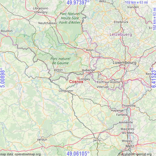
Cosnes GPS coordinates[2]
49° 31' 10.704" North, 5° 42' 43.56" East
| Map corner | latitude | longitude |
|---|---|---|
| Upper-left | 49.97397°, | 5.00898° |
| Center: | 49.51964°, | 5.7121° |
| Lower-right: | 49.06105°, | 6.41523° |
| Map W x H: | 101.5×101.5 km | = 63.1×63.1mi |
| max Lat: | 51.07786° ⇑10.4% North |
| Cosnes: | 49.51964° |
| min Lat: | ⇓89.6% South 41.3874° |
| min Long | Cosnes | max Long |
| -5.08615° | 5.7121° | 9.52242° |
| W 84.5%⇐ | ⇒15.5% E |
Elevation
Elevation of Cosnes is 378 m = 1240 ft, and this is 184.3 m = 605 ft above average elevation for this country.
| Max E: |
2333 m = 7654 ft | 12.7% |
| Cosnes | 378 m 1240 ft | |
| Avg. | 193.7 m = 635 ft | |
Min E: |
-1 m = -3 ft | 87.3% |
See also: France elevation on elevation.city.
Geographical zone
Cosnes is located in North temperate zone (between Tropic of Cancer and the Arctic Circle). Distance of this North polar circle is 1895.1 km =1177.6 mi to North.| Distance of | km | miles | from Cosnes |
|---|---|---|---|
| North Pole | 4501 | 2796.8 | to North |
| Arctic Circle | 1895.1 | 1177.6 | to North |
| Tropic Cancer | 2900.1 | 1802 | to South |
| Equator | 5506.1 | 3421.3 | to South |


Nearby cities:
15 places around Cosnes: (largest is in red/bold)
• Chenières
6.5 km =4 mi,  143°
143°
• Cons-la-Grandville
3.9 km =2.4 mi,  188°
188°
• Cutry
4.6 km =2.9 mi,  150°
150°
• Gorcy
2.6 km =1.6 mi,  310°
310°
• Herserange
5.6 km =3.5 mi,  89°
89°
• Lexy
2.5 km =1.6 mi, 149°
• Longlaville
6.6 km =4.1 mi,  75°
75°
• Longwy
3.6 km =2.2 mi, 86°
• Mexy
5.4 km =3.4 mi,  112°
112°
• Mont-Saint-Martin
5.8 km =3.6 mi,  62°
62°
• Réhon
3.9 km =2.4 mi,  126°
126°
• Tellancourt
5.9 km =3.7 mi,  256°
256°
• Ugny
5.5 km =3.4 mi, 191°
• Ville-Houdlémont
5.5 km =3.4 mi,  302°
302°
• Villers-la-Chèvre
2.1 km =1.3 mi,  212°
212°
Sources, notices
• [Note1] Compared only with cities in France existing in our database
• [Src1] Map data: © OpenStreetMap contributors (CC-BY-SA)
• [Src2] Other city data from geonames.org with taken over terms of usage.
• [Src3] Geographical zone / Annual Mean Temperature by Robert A. Rohde @ Wikipedia
