Bernin geodata
Bernin (Auvergne-Rhône-Alpes) is a populated place; located in France in Europe/Paris (GMT+2) time zone. With population of 3,129 people, there are 3115 cities with bigger population in this country. Compared to other cities in France, 76.7% of cities are located further ↑North; 85.6% of cities are located further ←West and 76.8% of cities have lower elevation than Bernin. Note1
Administrative division(s):
- Level 1: Auvergne-Rhône-Alpes
- Level 2: Département de l'Isère
- Level 3: Arrondissement de Grenoble
- Level 4: Bernin


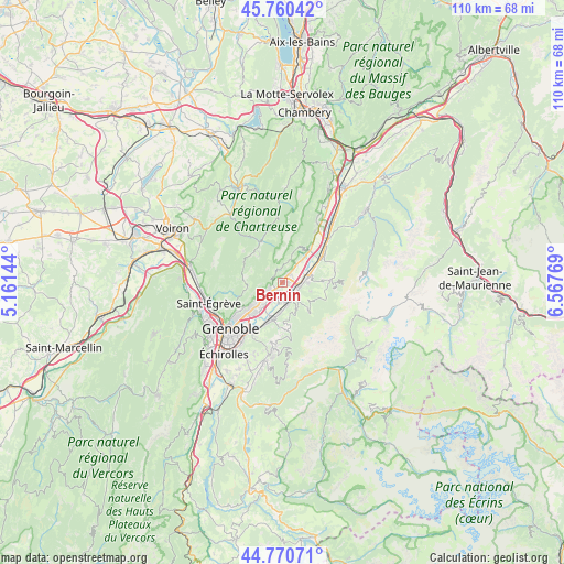
Bernin GPS coordinates[2]
45° 16' 3.792" North, 5° 51' 52.452" East
| Map corner | latitude | longitude |
|---|---|---|
| Upper-left | 45.76042°, | 5.16144° |
| Center: | 45.26772°, | 5.86457° |
| Lower-right: | 44.77071°, | 6.56769° |
| Map W x H: | 110×110 km | = 68.4×68.4mi |
| max Lat: | 51.07786° ⇑76.7% North |
| Bernin: | 45.26772° |
| min Lat: | ⇓23.3% South 41.3874° |
| min Long | Bernin | max Long |
| -5.08615° | 5.86457° | 9.52242° |
| W 85.6%⇐ | ⇒14.4% E |
Elevation
Elevation of Bernin is 262 m = 860 ft, and this is 68.3 m = 224 ft above average elevation for this country.
| Max E: |
2333 m = 7654 ft | 23.2% |
| Bernin | 262 m 860 ft | |
| Avg. | 193.7 m = 635 ft | |
Min E: |
-1 m = -3 ft | 76.8% |
See also: France elevation on elevation.city.
Geographical zone
Bernin is located in North temperate zone (between Tropic of Cancer and the Arctic Circle). Distance of this North polar circle is 2367.9 km =1471.3 mi to North.| Distance of | km | miles | from Bernin |
|---|---|---|---|
| North Pole | 4973.8 | 3090.6 | to North |
| Arctic Circle | 2367.9 | 1471.3 | to North |
| Tropic Cancer | 2427.4 | 1508.3 | to South |
| Equator | 5033.3 | 3127.5 | to South |


Nearby cities:
15 places around Bernin: (largest is in red/bold)
• Biviers
6.3 km =3.9 mi,  232°
232°
• Crolles
1.5 km =0.9 mi,  45°
45°
• Froges
4.5 km =2.8 mi,  81°
81°
• La Combe-de-Lancey
5.5 km =3.4 mi,  152°
152°
• Laval
5.6 km =3.5 mi,  107°
107°
• Le Champ-près-Froges
6.1 km =3.8 mi, 76°
• Le Sappey-en-Chartreuse
7.1 km =4.4 mi,  265°
265°
• Le Versoud
5.3 km =3.3 mi,  179°
179°
• Lumbin
6.1 km =3.8 mi,  40°
40°
• Montbonnot-Saint-Martin
6.8 km =4.2 mi, 226°
• Saint-Hilaire
3.9 km =2.4 mi,  22°
22°
• Saint-Ismier
3.2 km =2 mi,  237°
237°
• Saint-Nazaire-les-Eymes
2.3 km =1.4 mi,  204°
204°
• Sainte-Agnès
5.7 km =3.5 mi,  127°
127°
• Villard-Bonnot
4 km =2.5 mi,  158°
158°
Sources, notices
• [Note1] Compared only with cities in France existing in our database
• [Src1] Map data: © OpenStreetMap contributors (CC-BY-SA)
• [Src2] Other city data from geonames.org with taken over terms of usage.
• [Src3] Geographical zone / Annual Mean Temperature by Robert A. Rohde @ Wikipedia
