Anneville-Ambourville geodata
Anneville-Ambourville (Normandy) is a populated place; located in France in Europe/Paris (GMT+2) time zone. With population of 969 people, there are 9068 cities with bigger population in this country. Compared to other cities in France, 88.7% of cities are located further ↓South; 69.9% of cities are located further →East and 97.8% of cities have higher elevation than Anneville-Ambourville. Note1
Administrative division(s):
- Level 1: Normandy
- Level 2: Seine-Maritime
- Level 3: Arrondissement de Rouen
- Level 4: Anneville-Ambourville
Current local time in Anneville-Ambourville:
08:36 AM, SaturdayDifference from your time zone: hours


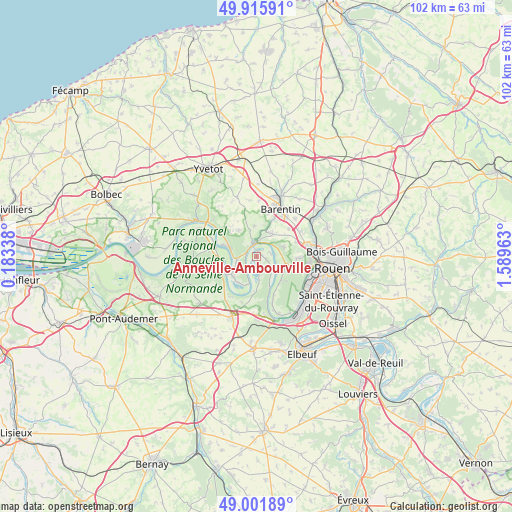
Anneville-Ambourville GPS coordinates[2]
49° 27' 39.708" North, 0° 53' 11.4" East
| Map corner | latitude | longitude |
|---|---|---|
| Upper-left | 49.91591°, | 0.18338° |
| Center: | 49.46103°, | 0.8865° |
| Lower-right: | 49.00189°, | 1.58963° |
| Map W x H: | 101.6×101.6 km | = 63.1×63.1mi |
| max Lat: | 51.07786° ⇑11.3% North |
| Anneville-Ambourville: | 49.46103° |
| min Lat: | ⇓88.7% South 41.3874° |
| min Long | Anneville-Ambou | max Long |
| -5.08615° | 0.8865° | 9.52242° |
| W 30.1%⇐ | ⇒69.9% E |
Elevation
Elevation of Anneville-Ambourville is 9 m = 30 ft, and this is 184.7 m = 606 ft below average elevation for this country.
| Max E: |
2333 m = 7654 ft | 97.8% |
| Avg. | 193.7 m = 635 ft | |
| Anneville-Ambourville | 9 m = 30 ft | |
Min E: |
-1 m = -3 ft | 2.2% |
See also: France elevation on elevation.city.
Geographical zone
Anneville-Ambourville is located in North temperate zone (between Tropic of Cancer and the Arctic Circle). Distance of this North polar circle is 1901.6 km =1181.6 mi to North.| Distance of | km | miles | from Anneville-Ambourville |
|---|---|---|---|
| North Pole | 4507.5 | 2800.8 | to North |
| Arctic Circle | 1901.6 | 1181.6 | to North |
| Tropic Cancer | 2893.6 | 1798 | to South |
| Equator | 5499.6 | 3417.3 | to South |


Nearby cities:
15 places around Anneville-Ambourville: (largest is in red/bold)
• Bardouville
4.1 km =2.5 mi,  135°
135°
• Berville-sur-Seine
1.7 km =1.1 mi,  44°
44°
• Duclair
2.6 km =1.6 mi,  343°
343°
• Hénouville
5.9 km =3.7 mi,  70°
70°
• Jumièges
5.8 km =3.6 mi,  237°
237°
• Le Mesnil-sous-Jumièges
5.9 km =3.7 mi,  199°
199°
• Le Trait
5.1 km =3.2 mi,  279°
279°
• Montigny
8.3 km =5.2 mi,  91°
91°
• Quevillon
6.7 km =4.2 mi,  133°
133°
• Saint-Martin-de-Boscherville
5.8 km =3.6 mi,  109°
109°
• Saint-Paër
6 km =3.7 mi,  355°
355°
• Saint-Pierre-de-Manneville
8.3 km =5.2 mi,  155°
155°
• Saint-Pierre-de-Varengeville
5.6 km =3.5 mi, 35°
• Sainte-Marguerite-sur-Duclair
6.1 km =3.8 mi,  329°
329°
• Yainville
4.2 km =2.6 mi,  258°
258°
Sources, notices
• [Note1] Compared only with cities in France existing in our database
• [Src1] Map data: © OpenStreetMap contributors (CC-BY-SA)
• [Src2] Other city data from geonames.org with taken over terms of usage.
• [Src3] Geographical zone / Annual Mean Temperature by Robert A. Rohde @ Wikipedia
