Whittlebury geodata
Whittlebury (England) is a populated place; located in United Kingdom in Europe/London (GMT+1) time zone. With population of 589 people, there are 4617 cities with bigger population in this country. Compared to other cities in United Kingdom, 59.5% of cities are located further ↑North; 66.8% of cities are located further ←West and 91.1% of cities have lower elevation than Whittlebury. Note1
Administrative division(s):
- Level 1: England
- Level 2: Northamptonshire
- Level 3: South Northamptonshire District
- Level 4: Whittlebury


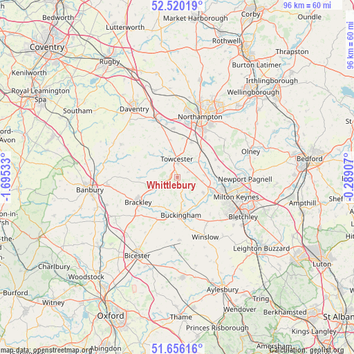
Whittlebury GPS coordinates[2]
52° 5' 24.972" North, 0° 59' 31.92" West
| Map corner | latitude | longitude |
|---|---|---|
| Upper-left | 52.52019°, | -1.69533° |
| Center: | 52.09027°, | -0.9922° |
| Lower-right: | 51.65616°, | -0.28907° |
| Map W x H: | 96.1×96.1 km | = 59.7×59.7mi |
| max Lat: | 60.39635° ⇑59.5% North |
| Whittlebury: | 52.09027° |
| min Lat: | ⇓40.5% South 34.60088° |
| min Long | Whittlebury | max Long |
| -7.64133° | -0.9922° | 32.95536° |
| W 66.8%⇐ | ⇒33.2% E |
Elevation
Elevation of Whittlebury is 156 m = 512 ft, and this is 83.1 m = 273 ft above average elevation for this country.
| Max E: |
515 m = 1690 ft | 8.9% |
| Whittlebury | 156 m 512 ft | |
| Avg. | 72.9 m = 239 ft | |
Min E: |
-30 m = -98 ft | 91.1% |
See also: United Kingdom elevation on elevation.city.
Geographical zone
Whittlebury is located in North temperate zone (between Tropic of Cancer and the Arctic Circle). Distance of this North polar circle is 1609.3 km =1000 mi to North.| Distance of | km | miles | from Whittlebury |
|---|---|---|---|
| North Pole | 4215.2 | 2619.2 | to North |
| Arctic Circle | 1609.3 | 1000 | to North |
| Tropic Cancer | 3186 | 1979.7 | to South |
| Equator | 5791.9 | 3598.9 | to South |


Nearby cities:
15 places around Whittlebury: (largest is in red/bold)
• Akeley
6.5 km =4 mi,  166°
166°
• Blakesley
9.1 km =5.7 mi,  313°
313°
• Blisworth
10 km =6.2 mi,  20°
20°
• Buckingham
10.1 km =6.3 mi,  178°
178°
• Cosgrove
10 km =6.2 mi,  99°
99°
• Deanshanger
8.5 km =5.3 mi,  121°
121°
• Helmdon
10.4 km =6.5 mi,  270°
270°
• Pattishall
10.5 km =6.5 mi,  349°
349°
• Paulerspury
3.2 km =2 mi,  64°
64°
• Potterspury
6.6 km =4.1 mi, 97°
• Roade
9.9 km =6.2 mi,  40°
40°
• Silverstone
2.3 km =1.4 mi,  275°
275°
• Stony Stratford
10.2 km =6.3 mi,  111°
111°
• Syresham
6.6 km =4.1 mi,  248°
248°
• Towcester
4.8 km =3 mi,  1°
1°
Sources, notices
• [Note1] Compared only with cities in United Kingdom existing in our database
• [Src1] Map data: © OpenStreetMap contributors (CC-BY-SA)
• [Src2] Other city data from geonames.org with taken over terms of usage.
• [Src3] Geographical zone / Annual Mean Temperature by Robert A. Rohde @ Wikipedia
