Tenby geodata
Tenby (Wales) is a seat of a third-order administrative division; located in United Kingdom in Europe/London (GMT+1) time zone. With population of 4,696 people, there are 1700 cities with bigger population in this country. Compared to other cities in United Kingdom, 71.9% of cities are located further ↑North; 94.7% of cities are located further →East and 74.7% of cities have higher elevation than Tenby. Note1


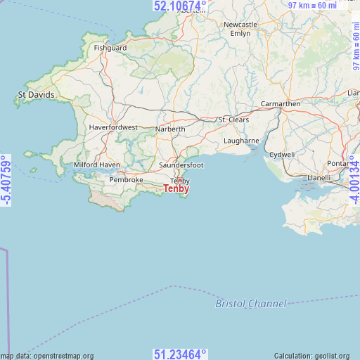
Tenby GPS coordinates[2]
51° 40' 22.044" North, 4° 42' 16.092" West
| Map corner | latitude | longitude |
|---|---|---|
| Upper-left | 52.10674°, | -5.40759° |
| Center: | 51.67279°, | -4.70447° |
| Lower-right: | 51.23464°, | -4.00134° |
| Map W x H: | 97×97 km | = 60.3×60.3mi |
| max Lat: | 60.39635° ⇑71.9% North |
| Tenby: | 51.67279° |
| min Lat: | ⇓28.1% South 34.60088° |
| min Long | Tenby | max Long |
| -7.64133° | -4.70447° | 32.95536° |
| W 5.3%⇐ | ⇒94.7% E |
Elevation
Elevation of Tenby is 27 m = 89 ft, and this is 45.9 m = 151 ft below average elevation for this country.
| Max E: |
515 m = 1690 ft | 74.7% |
| Avg. | 72.9 m = 239 ft | |
| Tenby | 27 m = 89 ft | |
Min E: |
-30 m = -98 ft | 25.3% |
See also: United Kingdom elevation on elevation.city.
Geographical zone
Tenby is located in North temperate zone (between Tropic of Cancer and the Arctic Circle). Distance of this North polar circle is 1655.7 km =1028.8 mi to North.| Distance of | km | miles | from Tenby |
|---|---|---|---|
| North Pole | 4261.6 | 2648 | to North |
| Arctic Circle | 1655.7 | 1028.8 | to North |
| Tropic Cancer | 3139.6 | 1950.9 | to South |
| Equator | 5745.5 | 3570.1 | to South |


Nearby cities:
15 places around Tenby: (largest is in red/bold)
• Burton
15.7 km =9.8 mi,  287°
287°
• Cosheston
13 km =8.1 mi,  281°
281°
• Jameston
7.7 km =4.8 mi,  256°
256°
• Jeffreyston
7.3 km =4.5 mi,  323°
323°
• Kilgetty
6.7 km =4.2 mi,  350°
350°
• Lamphey
11.6 km =7.2 mi,  266°
266°
• Llangwm
16.7 km =10.4 mi,  300°
300°
• Manorbier
7.2 km =4.5 mi,  245°
245°
• Narberth
14.2 km =8.8 mi, 349°
• Pembroke
14.4 km =8.9 mi, 270°
• Pembroke Dock
16.4 km =10.2 mi, 277°
• Penally
2 km =1.2 mi,  223°
223°
• Saundersfoot
4.1 km =2.5 mi,  2°
2°
• Stepaside
6.9 km =4.3 mi,  6°
6°
• Templeton
11.3 km =7 mi, 348°
Sources, notices
• [Note1] Compared only with cities in United Kingdom existing in our database
• [Src1] Map data: © OpenStreetMap contributors (CC-BY-SA)
• [Src2] Other city data from geonames.org with taken over terms of usage.
• [Src3] Geographical zone / Annual Mean Temperature by Robert A. Rohde @ Wikipedia
