Romford geodata
Romford (England) is a seat of a third-order administrative division; located in United Kingdom in Europe/London (GMT+1) time zone. With population of 95,000 people, there are 102 cities with bigger population in this country. Compared to other cities in United Kingdom, 75.3% of cities are located further ↑North; 88.9% of cities are located further ←West and 80.8% of cities have higher elevation than Romford. Note1


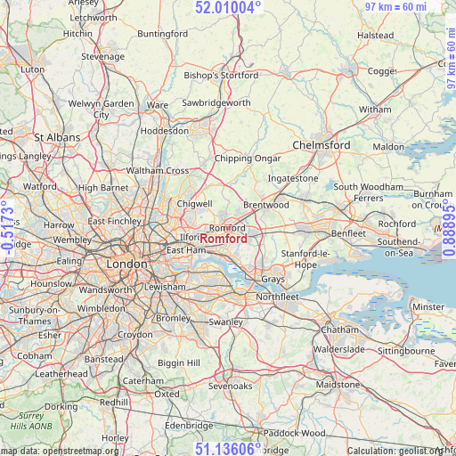
Romford GPS coordinates[2]
51° 34' 30.54" North, 0° 11' 8.952" East
| Map corner | latitude | longitude |
|---|---|---|
| Upper-left | 52.01004°, | -0.5173° |
| Center: | 51.57515°, | 0.18582° |
| Lower-right: | 51.13606°, | 0.88895° |
| Map W x H: | 97.2×97.2 km | = 60.4×60.4mi |
| max Lat: | 60.39635° ⇑75.3% North |
| Romford: | 51.57515° |
| min Lat: | ⇓24.7% South 34.60088° |
| min Long | Romford | max Long |
| -7.64133° | 0.18582° | 32.95536° |
| W 88.9%⇐ | ⇒11.1% E |
Elevation
Elevation of Romford is 20 m = 66 ft, and this is 52.9 m = 174 ft below average elevation for this country.
| Max E: |
515 m = 1690 ft | 80.8% |
| Avg. | 72.9 m = 239 ft | |
| Romford | 20 m = 66 ft | |
Min E: |
-30 m = -98 ft | 19.2% |
See also: Romford elevation on elevation.city.
Geographical zone
Romford is located in North temperate zone (between Tropic of Cancer and the Arctic Circle). Distance of this North polar circle is 1666.6 km =1035.6 mi to North.| Distance of | km | miles | from Romford |
|---|---|---|---|
| North Pole | 4272.4 | 2654.7 | to North |
| Arctic Circle | 1666.6 | 1035.6 | to North |
| Tropic Cancer | 3128.7 | 1944.1 | to South |
| Equator | 5734.6 | 3563.3 | to South |


Nearby cities:
15 places around Romford: (largest is in red/bold)
• Abridge
9.4 km =5.8 mi,  331°
331°
• Barking
8.5 km =5.3 mi,  236°
236°
• Becontree
4.6 km =2.9 mi, 237°
• Chadwell Heath
3.7 km =2.3 mi,  263°
263°
• Chigwell
9.1 km =5.7 mi,  303°
303°
• Collier Row
3 km =1.9 mi, 332°
• Cranham
5.6 km =3.5 mi,  100°
100°
• Dagenham
3.1 km =1.9 mi,  205°
205°
• Elm Park
3 km =1.9 mi,  159°
159°
• Grange Hill
8 km =5 mi, 300°
• Hainault
6.6 km =4.1 mi, 304°
• Harold Wood
3.9 km =2.4 mi,  56°
56°
• Hornchurch
2.9 km =1.8 mi,  133°
133°
• Ilford
8.1 km =5 mi, 256°
• Upminster
5.3 km =3.3 mi,  113°
113°
Sources, notices
• [Note1] Compared only with cities in United Kingdom existing in our database
• [Src1] Map data: © OpenStreetMap contributors (CC-BY-SA)
• [Src2] Other city data from geonames.org with taken over terms of usage.
• [Src3] Geographical zone / Annual Mean Temperature by Robert A. Rohde @ Wikipedia
