Reading geodata
Reading (England) is a seat of a second-order administrative division; located in United Kingdom in Europe/London (GMT+1) time zone. With population of 318,014 people, there are 18 cities with bigger population in this country. Compared to other cities in United Kingdom, 79.1% of cities are located further ↑North; 67.2% of cities are located further ←West and 56.8% of cities have higher elevation than Reading. Note1


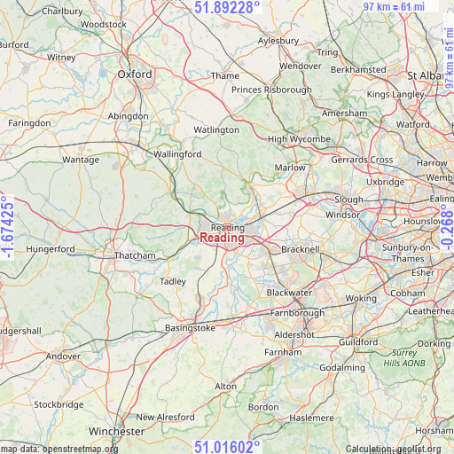
Reading GPS coordinates[2]
51° 27' 22.5" North, 0° 58' 16.068" West
| Map corner | latitude | longitude |
|---|---|---|
| Upper-left | 51.89228°, | -1.67425° |
| Center: | 51.45625°, | -0.97113° |
| Lower-right: | 51.01602°, | -0.268° |
| Map W x H: | 97.4×97.4 km | = 60.5×60.5mi |
| max Lat: | 60.39635° ⇑79.1% North |
| Reading: | 51.45625° |
| min Lat: | ⇓20.9% South 34.60088° |
| min Long | Reading | max Long |
| -7.64133° | -0.97113° | 32.95536° |
| W 67.2%⇐ | ⇒32.8% E |
Elevation
Elevation of Reading is 51 m = 167 ft, and this is 21.9 m = 72 ft below average elevation for this country.
| Max E: |
515 m = 1690 ft | 56.8% |
| Avg. | 72.9 m = 239 ft | |
| Reading | 51 m = 167 ft | |
Min E: |
-30 m = -98 ft | 43.2% |
See also: Reading elevation on elevation.city.
Geographical zone
Reading is located in North temperate zone (between Tropic of Cancer and the Arctic Circle). Distance of this North polar circle is 1679.8 km =1043.8 mi to North.| Distance of | km | miles | from Reading |
|---|---|---|---|
| North Pole | 4285.7 | 2663 | to North |
| Arctic Circle | 1679.8 | 1043.8 | to North |
| Tropic Cancer | 3115.5 | 1935.9 | to South |
| Equator | 5721.4 | 3555.1 | to South |


Nearby cities:
15 places around Reading: (largest is in red/bold)
• Binfield Heath
5.8 km =3.6 mi,  32°
32°
• Calcot
5.8 km =3.6 mi,  252°
252°
• Charvil
6.3 km =3.9 mi,  69°
69°
• Earley
3.7 km =2.3 mi,  117°
117°
• Hurst
8.3 km =5.2 mi,  88°
88°
• Lower Earley
4.8 km =3 mi,  132°
132°
• Shinfield
5.9 km =3.7 mi,  162°
162°
• Shiplake
6.8 km =4.2 mi,  43°
43°
• Sonning
4.5 km =2.8 mi,  64°
64°
• Sonning Common
7 km =4.3 mi,  356°
356°
• Theale
7.6 km =4.7 mi, 253°
• Tilehurst
5 km =3.1 mi,  270°
270°
• Twyford
8 km =5 mi, 74°
• Winnersh
7.1 km =4.4 mi, 116°
• Woodley
6.1 km =3.8 mi,  96°
96°
Sources, notices
• [Note1] Compared only with cities in United Kingdom existing in our database
• [Src1] Map data: © OpenStreetMap contributors (CC-BY-SA)
• [Src2] Other city data from geonames.org with taken over terms of usage.
• [Src3] Geographical zone / Annual Mean Temperature by Robert A. Rohde @ Wikipedia
