Port Erroll geodata
Port Erroll (Scotland) is a populated place; located in United Kingdom in Europe/London (GMT+1) time zone. With population of 1,620 people, there are 2930 cities with bigger population in this country. Compared to other cities in United Kingdom, 98.3% of cities are located further ↓South; 51.9% of cities are located further →East and 96.2% of cities have higher elevation than Port Erroll. Note1


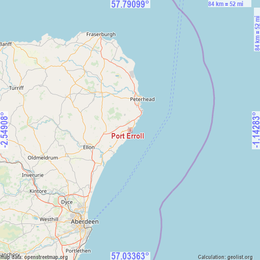
Port Erroll GPS coordinates[2]
57° 24' 51.372" North, 1° 50' 45.456" West
| Map corner | latitude | longitude |
|---|---|---|
| Upper-left | 57.79099°, | -2.54908° |
| Center: | 57.41427°, | -1.84596° |
| Lower-right: | 57.03363°, | -1.14283° |
| Map W x H: | 84.2×84.2 km | = 52.3×52.3mi |
| max Lat: | 60.39635° ⇑1.7% North |
| Port Erroll: | 57.41427° |
| min Lat: | ⇓98.3% South 34.60088° |
| min Long | Port Erroll | max Long |
| -7.64133° | -1.84596° | 32.95536° |
| W 48.1%⇐ | ⇒51.9% E |
Elevation
Elevation of Port Erroll is 7 m = 23 ft, and this is 65.9 m = 216 ft below average elevation for this country.
| Max E: |
515 m = 1690 ft | 96.2% |
| Avg. | 72.9 m = 239 ft | |
| Port Erroll | 7 m = 23 ft | |
Min E: |
-30 m = -98 ft | 3.8% |
See also: United Kingdom elevation on elevation.city.
Geographical zone
Port Erroll is located in North temperate zone (between Tropic of Cancer and the Arctic Circle). Distance of this North polar circle is 1017.3 km =632.1 mi to North.| Distance of | km | miles | from Port Erroll |
|---|---|---|---|
| North Pole | 3623.2 | 2251.4 | to North |
| Arctic Circle | 1017.3 | 632.1 | to North |
| Tropic Cancer | 3777.9 | 2347.5 | to South |
| Equator | 6383.9 | 3966.8 | to South |


Nearby cities:
15 places around Port Erroll: (largest is in red/bold)
• Balmedie
22.3 km =13.9 mi,  215°
215°
• Boddam
7.4 km =4.6 mi,  32°
32°
• Crimond
21.2 km =13.2 mi,  348°
348°
• Cruden Bay
0.6 km =0.4 mi,  313°
313°
• Ellon
14.7 km =9.1 mi,  247°
247°
• Hatton
4.7 km =2.9 mi,  283°
283°
• Longside
12.8 km =8 mi,  333°
333°
• Maud
20.6 km =12.8 mi, 305°
• Mintlaw
15.3 km =9.5 mi,  322°
322°
• Newburgh
14.4 km =8.9 mi, 221°
• Peterhead
10.6 km =6.6 mi,  15°
15°
• Pitmedden
21.8 km =13.5 mi, 246°
• Saint Fergus
16.2 km =10.1 mi,  0°
0°
• Stuartfield
15.5 km =9.6 mi, 309°
• Tarves
23 km =14.3 mi,  257°
257°
Sources, notices
• [Note1] Compared only with cities in United Kingdom existing in our database
• [Src1] Map data: © OpenStreetMap contributors (CC-BY-SA)
• [Src2] Other city data from geonames.org with taken over terms of usage.
• [Src3] Geographical zone / Annual Mean Temperature by Robert A. Rohde @ Wikipedia
