Northampton geodata
Northampton (England) is a seat of a second-order administrative division; located in United Kingdom in Europe/London (GMT+1) time zone. With population of 215,963 people, there are 35 cities with bigger population in this country. Compared to other cities in United Kingdom, 55.2% of cities are located further ↑North; 68.8% of cities are located further ←West and 70.7% of cities have lower elevation than Northampton. Note1


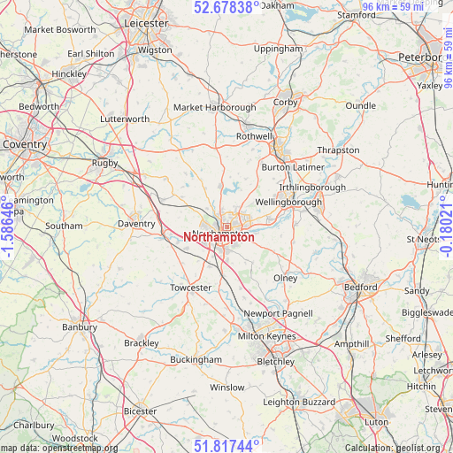
Northampton GPS coordinates[2]
52° 15' 0" North, 0° 52' 59.988" West
| Map corner | latitude | longitude |
|---|---|---|
| Upper-left | 52.67838°, | -1.58646° |
| Center: | 52.25°, | -0.88333° |
| Lower-right: | 51.81744°, | -0.18021° |
| Map W x H: | 95.7×95.7 km | = 59.5×59.5mi |
| max Lat: | 60.39635° ⇑55.2% North |
| Northampton: | 52.25° |
| min Lat: | ⇓44.8% South 34.60088° |
| min Long | Northampton | max Long |
| -7.64133° | -0.88333° | 32.95536° |
| W 68.8%⇐ | ⇒31.2% E |
Elevation
Elevation of Northampton is 97 m = 318 ft, and this is 24.1 m = 79 ft above average elevation for this country.
| Max E: |
515 m = 1690 ft | 29.3% |
| Northampton | 97 m 318 ft | |
| Avg. | 72.9 m = 239 ft | |
Min E: |
-30 m = -98 ft | 70.7% |
See also: Northampton elevation on elevation.city.
Geographical zone
Northampton is located in North temperate zone (between Tropic of Cancer and the Arctic Circle). Distance of this North polar circle is 1591.5 km =988.9 mi to North.| Distance of | km | miles | from Northampton |
|---|---|---|---|
| North Pole | 4197.4 | 2608.1 | to North |
| Arctic Circle | 1591.5 | 988.9 | to North |
| Tropic Cancer | 3203.7 | 1990.7 | to South |
| Equator | 5809.7 | 3610 | to South |


Nearby cities:
15 places around Northampton: (largest is in red/bold)
• Blisworth
9.2 km =5.7 mi,  205°
205°
• Brixworth
8.9 km =5.5 mi,  351°
351°
• Bugbrooke
9.9 km =6.2 mi,  243°
243°
• Cogenhoe
6.9 km =4.3 mi,  101°
101°
• Earls Barton
9.1 km =5.7 mi,  78°
78°
• Hackleton
8 km =5 mi,  149°
149°
• Hardingstone
4.1 km =2.5 mi,  182°
182°
• Harpole
7.3 km =4.5 mi,  263°
263°
• Kislingbury
6.9 km =4.3 mi,  250°
250°
• Nether Heyford
10.8 km =6.7 mi, 252°
• Pitsford
6 km =3.7 mi, 350°
• Roade
10.2 km =6.3 mi,  185°
185°
• Spratton
9.6 km =6 mi,  329°
329°
• Sywell
8 km =5 mi,  47°
47°
• Walgrave
10.8 km =6.7 mi,  21°
21°
Sources, notices
• [Note1] Compared only with cities in United Kingdom existing in our database
• [Src1] Map data: © OpenStreetMap contributors (CC-BY-SA)
• [Src2] Other city data from geonames.org with taken over terms of usage.
• [Src3] Geographical zone / Annual Mean Temperature by Robert A. Rohde @ Wikipedia
