Inverness geodata
Inverness (Scotland) is a seat of a second-order administrative division; located in United Kingdom in Europe/London (GMT+1) time zone. With population of 46,870 people, there are 253 cities with bigger population in this country. Compared to other cities in United Kingdom, 98.5% of cities are located further ↓South; 90.8% of cities are located further →East and 85.8% of cities have higher elevation than Inverness. Note1


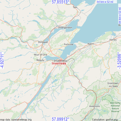
Inverness GPS coordinates[2]
57° 28' 44.688" North, 4° 13' 26.328" West
| Map corner | latitude | longitude |
|---|---|---|
| Upper-left | 57.85513°, | -4.92711° |
| Center: | 57.47908°, | -4.22398° |
| Lower-right: | 57.09912°, | -3.52086° |
| Map W x H: | 84.1×84.1 km | = 52.3×52.3mi |
| max Lat: | 60.39635° ⇑1.5% North |
| Inverness: | 57.47908° |
| min Lat: | ⇓98.5% South 34.60088° |
| min Long | Inverness | max Long |
| -7.64133° | -4.22398° | 32.95536° |
| W 9.2%⇐ | ⇒90.8% E |
Elevation
Elevation of Inverness is 15 m = 49 ft, and this is 57.9 m = 190 ft below average elevation for this country.
| Max E: |
515 m = 1690 ft | 85.8% |
| Avg. | 72.9 m = 239 ft | |
| Inverness | 15 m = 49 ft | |
Min E: |
-30 m = -98 ft | 14.2% |
See also: Inverness elevation on elevation.city.
Geographical zone
Inverness is located in North temperate zone (between Tropic of Cancer and the Arctic Circle). Distance of this North polar circle is 1010.1 km =627.6 mi to North.| Distance of | km | miles | from Inverness |
|---|---|---|---|
| North Pole | 3616 | 2246.9 | to North |
| Arctic Circle | 1010.1 | 627.6 | to North |
| Tropic Cancer | 3785.2 | 2352 | to South |
| Equator | 6391.1 | 3971.2 | to South |


Nearby cities:
15 places around Inverness: (largest is in red/bold)
• Ardersier
14.8 km =9.2 mi,  48°
48°
• Avoch
10.4 km =6.5 mi,  15°
15°
• Balloch
6.5 km =4 mi,  77°
77°
• Beauly
14.2 km =8.8 mi,  271°
271°
• Croy
12.1 km =7.5 mi,  69°
69°
• Culloden
5 km =3.1 mi, 79°
• Fortrose
12.6 km =7.8 mi,  25°
25°
• Highland
0.8 km =0.5 mi,  340°
340°
• Kirkhill
11.3 km =7 mi, 268°
• Milton of Leys
4.2 km =2.6 mi,  137°
137°
• Muir of Ord
14.8 km =9.2 mi,  287°
287°
• North Kessock
3 km =1.9 mi,  331°
331°
• Rosemarkie
14.1 km =8.8 mi, 27°
• Smithton
4.3 km =2.7 mi,  89°
89°
• Westhill
4.5 km =2.8 mi,  98°
98°
Sources, notices
• [Note1] Compared only with cities in United Kingdom existing in our database
• [Src1] Map data: © OpenStreetMap contributors (CC-BY-SA)
• [Src2] Other city data from geonames.org with taken over terms of usage.
• [Src3] Geographical zone / Annual Mean Temperature by Robert A. Rohde @ Wikipedia
