Invergordon geodata
Invergordon (Scotland) is a populated place; located in United Kingdom in Europe/London (GMT+1) time zone. With population of 4,130 people, there are 1809 cities with bigger population in this country. Compared to other cities in United Kingdom, 99.4% of cities are located further ↓South; 90.1% of cities are located further →East and 93.6% of cities have higher elevation than Invergordon. Note1


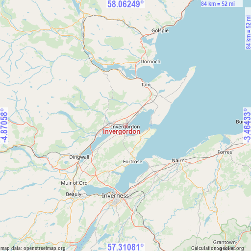
Invergordon GPS coordinates[2]
57° 41' 18.96" North, 4° 10' 2.82" West
| Map corner | latitude | longitude |
|---|---|---|
| Upper-left | 58.06249°, | -4.87058° |
| Center: | 57.6886°, | -4.16745° |
| Lower-right: | 57.31081°, | -3.46433° |
| Map W x H: | 83.6×83.6 km | = 51.9×51.9mi |
| max Lat: | 60.39635° ⇑0.6% North |
| Invergordon: | 57.6886° |
| min Lat: | ⇓99.4% South 34.60088° |
| min Long | Invergordon | max Long |
| -7.64133° | -4.16745° | 32.95536° |
| W 9.9%⇐ | ⇒90.1% E |
Elevation
Elevation of Invergordon is 9 m = 30 ft, and this is 63.9 m = 210 ft below average elevation for this country.
| Max E: |
515 m = 1690 ft | 93.6% |
| Avg. | 72.9 m = 239 ft | |
| Invergordon | 9 m = 30 ft | |
Min E: |
-30 m = -98 ft | 6.4% |
See also: United Kingdom elevation on elevation.city.
Geographical zone
Invergordon is located in North temperate zone (between Tropic of Cancer and the Arctic Circle). Distance of this North polar circle is 986.8 km =613.2 mi to North.| Distance of | km | miles | from Invergordon |
|---|---|---|---|
| North Pole | 3592.7 | 2232.4 | to North |
| Arctic Circle | 986.8 | 613.2 | to North |
| Tropic Cancer | 3808.5 | 2366.5 | to South |
| Equator | 6414.4 | 3985.7 | to South |


Nearby cities:
15 places around Invergordon: (largest is in red/bold)
• Alness
5.3 km =3.3 mi,  278°
278°
• Ardersier
15.6 km =9.7 mi,  150°
150°
• Avoch
13.3 km =8.3 mi,  182°
182°
• Balintore
16.9 km =10.5 mi,  63°
63°
• Conon Bridge
21 km =13 mi,  229°
229°
• Cromarty
8 km =5 mi,  96°
96°
• Croy
20.7 km =12.9 mi,  157°
157°
• Dingwall
18.6 km =11.6 mi,  236°
236°
• Evanton
10.6 km =6.6 mi,  254°
254°
• Fortrose
12.2 km =7.6 mi,  170°
170°
• Maryburgh
20.7 km =12.9 mi, 232°
• Nairn
20.9 km =13 mi,  124°
124°
• North Kessock
21.2 km =13.2 mi,  193°
193°
• Rosemarkie
11.2 km =7 mi, 163°
• Tain
14.8 km =9.2 mi,  25°
25°
Sources, notices
• [Note1] Compared only with cities in United Kingdom existing in our database
• [Src1] Map data: © OpenStreetMap contributors (CC-BY-SA)
• [Src2] Other city data from geonames.org with taken over terms of usage.
• [Src3] Geographical zone / Annual Mean Temperature by Robert A. Rohde @ Wikipedia
