Hamilton geodata
Hamilton (Scotland) is a seat of a second-order administrative division; located in United Kingdom in Europe/London (GMT+1) time zone. With population of 53,200 people, there are 217 cities with bigger population in this country. Compared to other cities in United Kingdom, 90.5% of cities are located further ↓South; 88.3% of cities are located further →East and 54.7% of cities have lower elevation than Hamilton. Note1


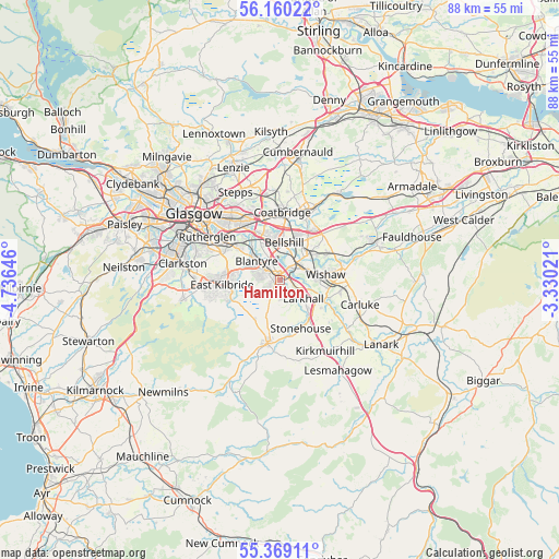
Hamilton GPS coordinates[2]
55° 46' 0.012" North, 4° 1' 59.988" West
| Map corner | latitude | longitude |
|---|---|---|
| Upper-left | 56.16022°, | -4.73646° |
| Center: | 55.76667°, | -4.03333° |
| Lower-right: | 55.36911°, | -3.33021° |
| Map W x H: | 88×88 km | = 54.7×54.7mi |
| max Lat: | 60.39635° ⇑9.5% North |
| Hamilton: | 55.76667° |
| min Lat: | ⇓90.5% South 34.60088° |
| min Long | Hamilton | max Long |
| -7.64133° | -4.03333° | 32.95536° |
| W 11.7%⇐ | ⇒88.3% E |
Elevation
Elevation of Hamilton is 68 m = 223 ft, and this is 4.9 m = 16 ft below average elevation for this country.
| Max E: |
515 m = 1690 ft | 45.3% |
| Avg. | 72.9 m = 239 ft | |
| Hamilton | 68 m = 223 ft | |
Min E: |
-30 m = -98 ft | 54.7% |
See also: Hamilton elevation on elevation.city.
Geographical zone
Hamilton is located in North temperate zone (between Tropic of Cancer and the Arctic Circle). Distance of this North polar circle is 1200.5 km =746 mi to North.| Distance of | km | miles | from Hamilton |
|---|---|---|---|
| North Pole | 3806.4 | 2365.2 | to North |
| Arctic Circle | 1200.5 | 746 | to North |
| Tropic Cancer | 3594.8 | 2233.7 | to South |
| Equator | 6200.7 | 3852.9 | to South |


Nearby cities:
15 places around Hamilton: (largest is in red/bold)
• Bellshill
5.7 km =3.5 mi,  10°
10°
• Blantyre
5.1 km =3.2 mi,  310°
310°
• Bothwell
4.6 km =2.9 mi,  331°
331°
• Carfin
6.2 km =3.9 mi,  46°
46°
• Chapelton
7.2 km =4.5 mi,  212°
212°
• High Blantyre
4.6 km =2.9 mi,  295°
295°
• Holytown
7 km =4.3 mi,  32°
32°
• Larkhall
5.6 km =3.5 mi,  131°
131°
• Motherwell
3.6 km =2.2 mi, 45°
• New Stevenston
6.7 km =4.2 mi, 33°
• Overtown
7.4 km =4.6 mi,  98°
98°
• Quarter
3.2 km =2 mi,  178°
178°
• Uddingston
6.7 km =4.2 mi, 331°
• Viewpark
6.9 km =4.3 mi,  347°
347°
• Wishaw
7.3 km =4.5 mi,  90°
90°
Sources, notices
• [Note1] Compared only with cities in United Kingdom existing in our database
• [Src1] Map data: © OpenStreetMap contributors (CC-BY-SA)
• [Src2] Other city data from geonames.org with taken over terms of usage.
• [Src3] Geographical zone / Annual Mean Temperature by Robert A. Rohde @ Wikipedia
