Bures Saint Mary geodata
Bures Saint Mary (England) is a populated place; located in United Kingdom in Europe/London (GMT+1) time zone. With population of 1,433 people, there are 3109 cities with bigger population in this country. Compared to other cities in United Kingdom, 62.9% of cities are located further ↑North; 94.9% of cities are located further ←West and 77.8% of cities have higher elevation than Bures Saint Mary. Note1
Administrative division(s):
- Level 1: England
- Level 2: Suffolk
- Level 3: Babergh District
- Level 4: Bures St. Mary


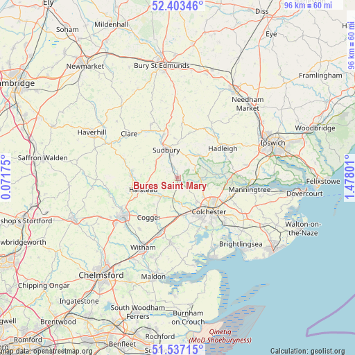
Bures Saint Mary GPS coordinates[2]
51° 58' 20.64" North, 0° 46' 29.568" East
| Map corner | latitude | longitude |
|---|---|---|
| Upper-left | 52.40346°, | 0.07175° |
| Center: | 51.9724°, | 0.77488° |
| Lower-right: | 51.53715°, | 1.47801° |
| Map W x H: | 96.3×96.3 km | = 59.8×59.8mi |
| max Lat: | 60.39635° ⇑62.9% North |
| Bures Saint Mary: | 51.9724° |
| min Lat: | ⇓37.1% South 34.60088° |
| min Long | Bures Saint Mar | max Long |
| -7.64133° | 0.77488° | 32.95536° |
| W 94.9%⇐ | ⇒5.1% E |
Elevation
Elevation of Bures Saint Mary is 23 m = 75 ft, and this is 49.9 m = 164 ft below average elevation for this country.
| Max E: |
515 m = 1690 ft | 77.8% |
| Avg. | 72.9 m = 239 ft | |
| Bures Saint Mary | 23 m = 75 ft | |
Min E: |
-30 m = -98 ft | 22.2% |
See also: United Kingdom elevation on elevation.city.
Geographical zone
Bures Saint Mary is located in North temperate zone (between Tropic of Cancer and the Arctic Circle). Distance of this North polar circle is 1622.4 km =1008.1 mi to North.| Distance of | km | miles | from Bures Saint Mary |
|---|---|---|---|
| North Pole | 4228.3 | 2627.3 | to North |
| Arctic Circle | 1622.4 | 1008.1 | to North |
| Tropic Cancer | 3172.9 | 1971.5 | to South |
| Equator | 5778.8 | 3590.8 | to South |


Nearby cities:
15 places around Bures Saint Mary: (largest is in red/bold)
• Boxford
8.5 km =5.3 mi,  42°
42°
• Boxted
9.6 km =6 mi,  105°
105°
• Castle Hedingham
12.2 km =7.6 mi,  279°
279°
• Earls Colne
7.1 km =4.4 mi,  225°
225°
• Eight Ash Green
9.1 km =5.7 mi,  158°
158°
• Great Horkesley
7.9 km =4.9 mi,  118°
118°
• Great Tey
8.3 km =5.2 mi,  192°
192°
• Great Waldingfield
9.2 km =5.7 mi,  359°
359°
• Halstead
9.8 km =6.1 mi,  251°
251°
• Long Melford
12.1 km =7.5 mi,  340°
340°
• Marks Tey
10.7 km =6.6 mi,  183°
183°
• Nayland
6.6 km =4.1 mi,  89°
89°
• Sible Hedingham
12.5 km =7.8 mi,  272°
272°
• Sudbury
8 km =5 mi, 337°
• West Bergholt
8.4 km =5.2 mi,  142°
142°
Sources, notices
• [Note1] Compared only with cities in United Kingdom existing in our database
• [Src1] Map data: © OpenStreetMap contributors (CC-BY-SA)
• [Src2] Other city data from geonames.org with taken over terms of usage.
• [Src3] Geographical zone / Annual Mean Temperature by Robert A. Rohde @ Wikipedia
