Bridgwater geodata
Bridgwater (England) is a populated place; located in United Kingdom in Europe/London (GMT+1) time zone. With population of 41,276 people, there are 295 cities with bigger population in this country. Compared to other cities in United Kingdom, 88.5% of cities are located further ↑North; 75.4% of cities are located further →East and 85.8% of cities have higher elevation than Bridgwater. Note1
Administrative division(s):
- Level 1: England
- Level 2: Somerset
- Level 3: Sedgemoor District
- Level 4: Bridgwater


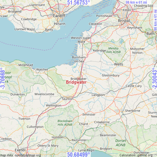
Bridgwater GPS coordinates[2]
51° 7' 42.132" North, 3° 0' 12.816" West
| Map corner | latitude | longitude |
|---|---|---|
| Upper-left | 51.56753°, | -3.70668° |
| Center: | 51.12837°, | -3.00356° |
| Lower-right: | 50.68499°, | -2.30043° |
| Map W x H: | 98.1×98.1 km | = 61×61mi |
| max Lat: | 60.39635° ⇑88.5% North |
| Bridgwater: | 51.12837° |
| min Lat: | ⇓11.5% South 34.60088° |
| min Long | Bridgwater | max Long |
| -7.64133° | -3.00356° | 32.95536° |
| W 24.6%⇐ | ⇒75.4% E |
Elevation
Elevation of Bridgwater is 15 m = 49 ft, and this is 57.9 m = 190 ft below average elevation for this country.
| Max E: |
515 m = 1690 ft | 85.8% |
| Avg. | 72.9 m = 239 ft | |
| Bridgwater | 15 m = 49 ft | |
Min E: |
-30 m = -98 ft | 14.2% |
See also: Bridgwater elevation on elevation.city.
Geographical zone
Bridgwater is located in North temperate zone (between Tropic of Cancer and the Arctic Circle). Distance of this North polar circle is 1716.2 km =1066.4 mi to North.| Distance of | km | miles | from Bridgwater |
|---|---|---|---|
| North Pole | 4322.1 | 2685.6 | to North |
| Arctic Circle | 1716.2 | 1066.4 | to North |
| Tropic Cancer | 3079 | 1913.2 | to South |
| Equator | 5684.9 | 3532.4 | to South |


Nearby cities:
15 places around Bridgwater: (largest is in red/bold)
• Cossington
6.7 km =4.2 mi,  59°
59°
• Creech Saint Michael
11.9 km =7.4 mi,  191°
191°
• East Huntspill
9.3 km =5.8 mi,  28°
28°
• Highbridge
9.9 km =6.2 mi,  8°
8°
• Huntspill
8.7 km =5.4 mi, 7°
• Middlezoy
8.8 km =5.5 mi,  118°
118°
• Nether Stowey
11 km =6.8 mi,  283°
283°
• North Petherton
4.1 km =2.5 mi, 191°
• Othery
10.1 km =6.3 mi, 121°
• Pawlett
5.8 km =3.6 mi,  0°
0°
• Puriton
5.1 km =3.2 mi, 25°
• Shapwick
12 km =7.5 mi,  83°
83°
• Stogursey
11.2 km =7 mi,  300°
300°
• Westonzoyland
5.7 km =3.5 mi,  112°
112°
• Woolavington
6.1 km =3.8 mi,  48°
48°
Sources, notices
• [Note1] Compared only with cities in United Kingdom existing in our database
• [Src1] Map data: © OpenStreetMap contributors (CC-BY-SA)
• [Src2] Other city data from geonames.org with taken over terms of usage.
• [Src3] Geographical zone / Annual Mean Temperature by Robert A. Rohde @ Wikipedia
