Bletchley geodata
Bletchley (England) is a populated place; located in United Kingdom in Europe/London (GMT+1) time zone. With population of 50,193 people, there are 232 cities with bigger population in this country. Compared to other cities in United Kingdom, 62.3% of cities are located further ↑North; 71.6% of cities are located further ←West and 63.2% of cities have lower elevation than Bletchley. Note1
Administrative division(s):
- Level 1: England
- Level 2: Milton Keynes
- Level 3: Bletchley and Fenny Stratford


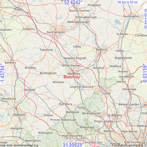
Bletchley GPS coordinates[2]
51° 59' 36.024" North, 0° 44' 4.956" West
| Map corner | latitude | longitude |
|---|---|---|
| Upper-left | 52.4242°, | -1.43784° |
| Center: | 51.99334°, | -0.73471° |
| Lower-right: | 51.55829°, | -0.03159° |
| Map W x H: | 96.3×96.3 km | = 59.8×59.8mi |
| max Lat: | 60.39635° ⇑62.3% North |
| Bletchley: | 51.99334° |
| min Lat: | ⇓37.7% South 34.60088° |
| min Long | Bletchley | max Long |
| -7.64133° | -0.73471° | 32.95536° |
| W 71.6%⇐ | ⇒28.4% E |
Elevation
Elevation of Bletchley is 82 m = 269 ft, and this is 9.1 m = 30 ft above average elevation for this country.
| Max E: |
515 m = 1690 ft | 36.8% |
| Bletchley | 82 m 269 ft | |
| Avg. | 72.9 m = 239 ft | |
Min E: |
-30 m = -98 ft | 63.2% |
See also: Bletchley elevation on elevation.city.
Geographical zone
Bletchley is located in North temperate zone (between Tropic of Cancer and the Arctic Circle). Distance of this North polar circle is 1620.1 km =1006.7 mi to North.| Distance of | km | miles | from Bletchley |
|---|---|---|---|
| North Pole | 4225.9 | 2625.9 | to North |
| Arctic Circle | 1620.1 | 1006.7 | to North |
| Tropic Cancer | 3175.2 | 1973 | to South |
| Equator | 5781.1 | 3592.2 | to South |


Nearby cities:
15 places around Bletchley: (largest is in red/bold)
• Bow Brickhill
3.8 km =2.4 mi,  74°
74°
• Bradwell
7.1 km =4.4 mi,  329°
329°
• Broughton
6.9 km =4.3 mi,  23°
23°
• Drayton Parslow
5.8 km =3.6 mi,  212°
212°
• Great Brickhill
4.4 km =2.7 mi,  133°
133°
• Loughton
5.4 km =3.4 mi,  319°
319°
• Milton Keynes
5.6 km =3.5 mi,  344°
344°
• Newton Longville
2.9 km =1.8 mi,  227°
227°
• Shenley Church End
5.2 km =3.2 mi,  313°
313°
• Simpson
3.5 km =2.2 mi,  42°
42°
• Stoke Hammond
4.2 km =2.6 mi,  165°
165°
• Water Eaton
1.1 km =0.7 mi, 128°
• Wavendon
5.5 km =3.4 mi,  49°
49°
• Whaddon
6.4 km =4 mi,  277°
277°
• Woburn Sands
6.3 km =3.9 mi, 66°
Sources, notices
• [Note1] Compared only with cities in United Kingdom existing in our database
• [Src1] Map data: © OpenStreetMap contributors (CC-BY-SA)
• [Src2] Other city data from geonames.org with taken over terms of usage.
• [Src3] Geographical zone / Annual Mean Temperature by Robert A. Rohde @ Wikipedia
