Barton-le-Clay geodata
Barton-le-Clay (England) is a seat of a third-order administrative division; located in United Kingdom in Europe/London (GMT+1) time zone. With population of 4,992 people, there are 1640 cities with bigger population in this country. Compared to other cities in United Kingdom, 63.1% of cities are located further ↑North; 78.3% of cities are located further ←West and 55.8% of cities have lower elevation than Barton-le-Clay. Note1


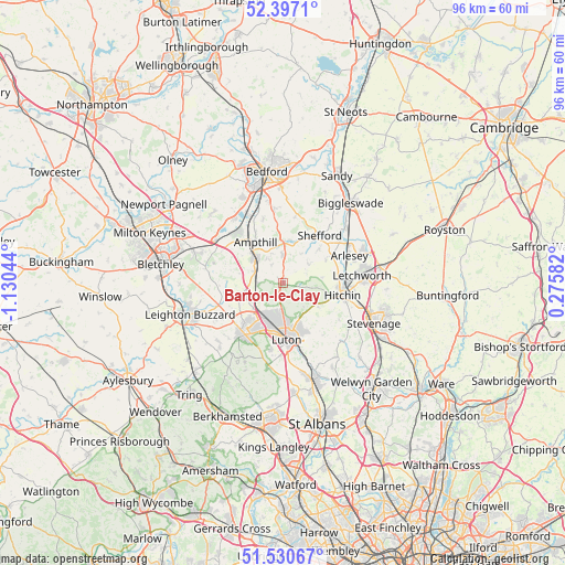
Barton-le-Clay GPS coordinates[2]
51° 57' 57.528" North, 0° 25' 38.316" West
| Map corner | latitude | longitude |
|---|---|---|
| Upper-left | 52.3971°, | -1.13044° |
| Center: | 51.96598°, | -0.42731° |
| Lower-right: | 51.53067°, | 0.27582° |
| Map W x H: | 96.3×96.3 km | = 59.8×59.8mi |
| max Lat: | 60.39635° ⇑63.1% North |
| Barton-le-Clay: | 51.96598° |
| min Lat: | ⇓36.9% South 34.60088° |
| min Long | Barton-le-Clay | max Long |
| -7.64133° | -0.42731° | 32.95536° |
| W 78.3%⇐ | ⇒21.7% E |
Elevation
Elevation of Barton-le-Clay is 70 m = 230 ft, and this is 2.9 m = 10 ft below average elevation for this country.
| Max E: |
515 m = 1690 ft | 44.2% |
| Avg. | 72.9 m = 239 ft | |
| Barton-le-Clay | 70 m = 230 ft | |
Min E: |
-30 m = -98 ft | 55.8% |
See also: United Kingdom elevation on elevation.city.
Geographical zone
Barton-le-Clay is located in North temperate zone (between Tropic of Cancer and the Arctic Circle). Distance of this North polar circle is 1623.1 km =1008.5 mi to North.| Distance of | km | miles | from Barton-le-Clay |
|---|---|---|---|
| North Pole | 4229 | 2627.8 | to North |
| Arctic Circle | 1623.1 | 1008.5 | to North |
| Tropic Cancer | 3172.2 | 1971.1 | to South |
| Equator | 5778.1 | 3590.3 | to South |


Nearby cities:
15 places around Barton-le-Clay: (largest is in red/bold)
• Chalton
6.6 km =4.1 mi,  230°
230°
• Clophill
6.8 km =4.2 mi,  2°
2°
• Flitwick
6.2 km =3.9 mi,  312°
312°
• Gravenhurst
6.2 km =3.9 mi,  39°
39°
• Great Offley
7.6 km =4.7 mi,  124°
124°
• Greenfield
4.9 km =3 mi,  327°
327°
• Harlington
4.5 km =2.8 mi,  265°
265°
• Pirton
6.4 km =4 mi,  84°
84°
• Pulloxhill
3.7 km =2.3 mi, 331°
• Shillington
5.5 km =3.4 mi,  56°
56°
• Silsoe
4.7 km =2.9 mi, 2°
• Streatley
2.5 km =1.6 mi,  207°
207°
• Toddington
7.5 km =4.7 mi,  255°
255°
• Upper Gravenhurst
6.1 km =3.8 mi,  33°
33°
• Westoning
5.1 km =3.2 mi,  289°
289°
Sources, notices
• [Note1] Compared only with cities in United Kingdom existing in our database
• [Src1] Map data: © OpenStreetMap contributors (CC-BY-SA)
• [Src2] Other city data from geonames.org with taken over terms of usage.
• [Src3] Geographical zone / Annual Mean Temperature by Robert A. Rohde @ Wikipedia
