Ashford geodata
Ashford (England) is a seat of a third-order administrative division; located in United Kingdom in Europe/London (GMT+1) time zone. With population of 62,787 people, there are 173 cities with bigger population in this country. Compared to other cities in United Kingdom, 88.2% of cities are located further ↑North; 95.5% of cities are located further ←West and 57.5% of cities have higher elevation than Ashford. Note1


Ashford GPS coordinates[2]
51° 8' 47.328" North, 0° 52' 25.536" East
| Map corner | latitude | longitude |
|---|---|---|
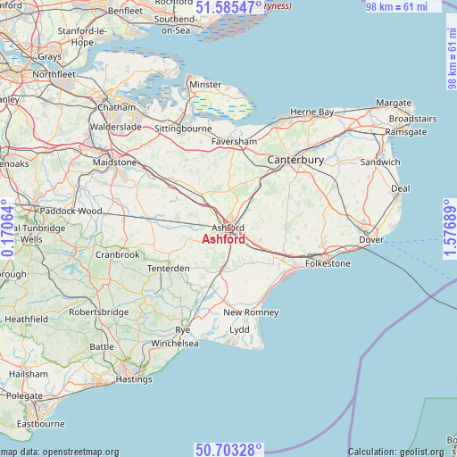
| Upper-left | 51.58547°, | 0.17064° |
| Center: | 51.14648°, | 0.87376° |
| Lower-right: | 50.70328°, | 1.57689° |
| Map W x H: | 98.1×98.1 km | = 61×61mi |
| max Lat: | 60.39635° ⇑88.2% North |
| Ashford: | 51.14648° |
| min Lat: | ⇓11.8% South 34.60088° |
| min Long | Ashford | max Long |
| -7.64133° | 0.87376° | 32.95536° |
| W 95.5%⇐ | ⇒4.5% E |
Elevation
Elevation of Ashford is 50 m = 164 ft, and this is 22.9 m = 75 ft below average elevation for this country.
| Max E: |
515 m = 1690 ft | 57.5% |
| Avg. | 72.9 m = 239 ft | |
| Ashford | 50 m = 164 ft | |
Min E: |
-30 m = -98 ft | 42.5% |
See also: Ashford elevation on elevation.city.
Geographical zone
Ashford is located in North temperate zone (between Tropic of Cancer and the Arctic Circle). Distance of this North polar circle is 1714.2 km =1065.2 mi to North.| Distance of | km | miles | from Ashford |
|---|---|---|---|
| North Pole | 4320.1 | 2684.4 | to North |
| Arctic Circle | 1714.2 | 1065.2 | to North |
| Tropic Cancer | 3081 | 1914.4 | to South |
| Equator | 5687 | 3533.7 | to South |


Nearby cities:
15 places around Ashford: (largest is in red/bold)
• Aldington
7.9 km =4.9 mi,  140°
140°
• Bethersden
8.7 km =5.4 mi,  256°
256°
• Charing
9 km =5.6 mi,  322°
322°
• High Halden
12.1 km =7.5 mi,  246°
246°
• Ivychurch
14.9 km =9.3 mi,  175°
175°
• Kennington
2.5 km =1.6 mi,  18°
18°
• Lenham
14.8 km =9.2 mi,  313°
313°
• Lympne
13.2 km =8.2 mi,  125°
125°
• Mersham
5.1 km =3.2 mi, 126°
• Romney Marsh
14 km =8.7 mi,  168°
168°
• Sellindge
10.4 km =6.5 mi,  117°
117°
• Shadoxhurst
5.7 km =3.5 mi,  221°
221°
• Smarden
13 km =8.1 mi,  271°
271°
• Woodchurch
10.5 km =6.5 mi, 221°
• Wye
5.9 km =3.7 mi,  47°
47°
Sources, notices
• [Note1] Compared only with cities in United Kingdom existing in our database
• [Src1] Map data: © OpenStreetMap contributors (CC-BY-SA)
• [Src2] Other city data from geonames.org with taken over terms of usage.
• [Src3] Geographical zone / Annual Mean Temperature by Robert A. Rohde @ Wikipedia
