Ammanford geodata
Ammanford (Wales) is a populated place; located in United Kingdom in Europe/London (GMT+1) time zone. With population of 23,709 people, there are 501 cities with bigger population in this country. Compared to other cities in United Kingdom, 68.1% of cities are located further ↑North; 87.8% of cities are located further →East and 65.5% of cities have higher elevation than Ammanford. Note1


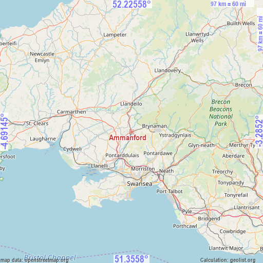
Ammanford GPS coordinates[2]
51° 47' 34.044" North, 3° 59' 17.988" West
| Map corner | latitude | longitude |
|---|---|---|
| Upper-left | 52.22558°, | -4.69145° |
| Center: | 51.79279°, | -3.98833° |
| Lower-right: | 51.3558°, | -3.2852° |
| Map W x H: | 96.7×96.7 km | = 60.1×60.1mi |
| max Lat: | 60.39635° ⇑68.1% North |
| Ammanford: | 51.79279° |
| min Lat: | ⇓31.9% South 34.60088° |
| min Long | Ammanford | max Long |
| -7.64133° | -3.98833° | 32.95536° |
| W 12.2%⇐ | ⇒87.8% E |
Elevation
Elevation of Ammanford is 39 m = 128 ft, and this is 33.9 m = 111 ft below average elevation for this country.
| Max E: |
515 m = 1690 ft | 65.5% |
| Avg. | 72.9 m = 239 ft | |
| Ammanford | 39 m = 128 ft | |
Min E: |
-30 m = -98 ft | 34.5% |
See also: United Kingdom elevation on elevation.city.
Geographical zone
Ammanford is located in North temperate zone (between Tropic of Cancer and the Arctic Circle). Distance of this North polar circle is 1642.4 km =1020.5 mi to North.| Distance of | km | miles | from Ammanford |
|---|---|---|---|
| North Pole | 4248.2 | 2639.7 | to North |
| Arctic Circle | 1642.4 | 1020.5 | to North |
| Tropic Cancer | 3152.9 | 1959.1 | to South |
| Equator | 5758.8 | 3578.4 | to South |


Nearby cities:
15 places around Ammanford: (largest is in red/bold)
• Brynamman
8.4 km =5.2 mi,  84°
84°
• Clydach
13.6 km =8.5 mi,  153°
153°
• Cross Hands
6.8 km =4.2 mi,  270°
270°
• Glanamman
3.9 km =2.4 mi, 78°
• Grovesend
12.5 km =7.8 mi,  195°
195°
• Llanddarog
13.4 km =8.3 mi,  286°
286°
• Llandeilo
10.2 km =6.3 mi,  358°
358°
• Llandybie
3.3 km =2.1 mi,  337°
337°
• Llangathen
10.7 km =6.6 mi,  334°
334°
• Llannon
9.8 km =6.1 mi,  244°
244°
• Pontarddulais
9.4 km =5.8 mi, 201°
• Pontlliw
11.4 km =7.1 mi,  187°
187°
• Pontyberem
12.5 km =7.8 mi,  262°
262°
• Tumble
8.4 km =5.2 mi, 263°
• Tycroes
2.7 km =1.7 mi,  233°
233°
Sources, notices
• [Note1] Compared only with cities in United Kingdom existing in our database
• [Src1] Map data: © OpenStreetMap contributors (CC-BY-SA)
• [Src2] Other city data from geonames.org with taken over terms of usage.
• [Src3] Geographical zone / Annual Mean Temperature by Robert A. Rohde @ Wikipedia
