Alnwick geodata
Alnwick (England) is a populated place; located in United Kingdom in Europe/London (GMT+1) time zone. With population of 8,116 people, there are 1213 cities with bigger population in this country. Compared to other cities in United Kingdom, 88.4% of cities are located further ↓South; 50.7% of cities are located further ←West and 51.1% of cities have lower elevation than Alnwick. Note1


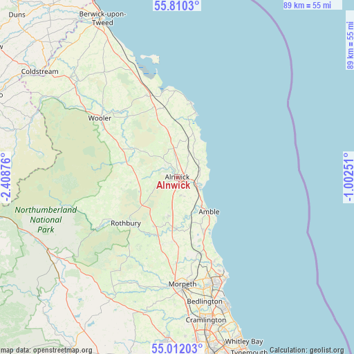
Alnwick GPS coordinates[2]
55° 24' 47.448" North, 1° 42' 20.268" West
| Map corner | latitude | longitude |
|---|---|---|
| Upper-left | 55.8103°, | -2.40876° |
| Center: | 55.41318°, | -1.70563° |
| Lower-right: | 55.01203°, | -1.00251° |
| Map W x H: | 88.8×88.8 km | = 55.2×55.2mi |
| max Lat: | 60.39635° ⇑11.6% North |
| Alnwick: | 55.41318° |
| min Lat: | ⇓88.4% South 34.60088° |
| min Long | Alnwick | max Long |
| -7.64133° | -1.70563° | 32.95536° |
| W 50.7%⇐ | ⇒49.3% E |
Elevation
Elevation of Alnwick is 62 m = 203 ft, and this is 10.9 m = 36 ft below average elevation for this country.
| Max E: |
515 m = 1690 ft | 48.9% |
| Avg. | 72.9 m = 239 ft | |
| Alnwick | 62 m = 203 ft | |
Min E: |
-30 m = -98 ft | 51.1% |
See also: United Kingdom elevation on elevation.city.
Geographical zone
Alnwick is located in North temperate zone (between Tropic of Cancer and the Arctic Circle). Distance of this North polar circle is 1239.8 km =770.4 mi to North.| Distance of | km | miles | from Alnwick |
|---|---|---|---|
| North Pole | 3845.7 | 2389.6 | to North |
| Arctic Circle | 1239.8 | 770.4 | to North |
| Tropic Cancer | 3555.4 | 2209.2 | to South |
| Equator | 6161.4 | 3828.5 | to South |


Nearby cities:
15 places around Alnwick: (largest is in red/bold)
• Acklington
13.4 km =8.3 mi,  160°
160°
• Alnmouth
6.8 km =4.2 mi,  102°
102°
• Amble
11.8 km =7.3 mi,  138°
138°
• East Chevington
16.4 km =10.2 mi,  151°
151°
• Ellingham
12.7 km =7.9 mi,  351°
351°
• Embleton
10.2 km =6.3 mi,  25°
25°
• Felton
12.8 km =8 mi,  181°
181°
• Hadston
14.7 km =9.1 mi, 154°
• Lesbury
5.2 km =3.2 mi,  108°
108°
• Longframlington
13.4 km =8.3 mi,  204°
204°
• Longhoughton
6 km =3.7 mi,  70°
70°
• Shilbottle
4.8 km =3 mi,  166°
166°
• Swarland
10.2 km =6.3 mi,  194°
194°
• Warkworth
9 km =5.6 mi, 141°
• Whittingham
11.9 km =7.4 mi,  263°
263°
Sources, notices
• [Note1] Compared only with cities in United Kingdom existing in our database
• [Src1] Map data: © OpenStreetMap contributors (CC-BY-SA)
• [Src2] Other city data from geonames.org with taken over terms of usage.
• [Src3] Geographical zone / Annual Mean Temperature by Robert A. Rohde @ Wikipedia
