Horringer geodata
Horringer (England) is a populated place; located in United Kingdom in Europe/London (GMT+0) time zone. With population of 780 people, there are 4066 cities with bigger population in this country. Compared to other cities in United Kingdom, 55.9% of cities are located further ↑North; 94% of cities are located further ←West and 66.5% of cities have lower elevation than Horringer. Note1
Administrative division(s):
- Level 1: England
- Level 2: Suffolk
- Level 3: St. Edmundsbury District
- Level 4: Horringer


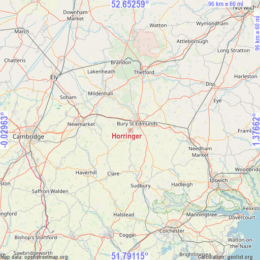
Horringer GPS coordinates[2]
52° 13' 26.256" North, 0° 40' 24.6" East
| Map corner | latitude | longitude |
|---|---|---|
| Upper-left | 52.65259°, | -0.02963° |
| Center: | 52.22396°, | 0.6735° |
| Lower-right: | 51.79115°, | 1.37662° |
| Map W x H: | 95.8×95.8 km | = 59.5×59.5mi |
| max Lat: | 60.39635° ⇑55.9% North |
| Horringer: | 52.22396° |
| min Lat: | ⇓44.1% South 34.60088° |
| min Long | Horringer | max Long |
| -7.64133° | 0.6735° | 32.95536° |
| W 94%⇐ | ⇒6% E |
Elevation
Elevation of Horringer is 89 m = 292 ft, and this is 16.1 m = 53 ft above average elevation for this country.
| Max E: |
515 m = 1690 ft | 33.5% |
| Horringer | 89 m 292 ft | |
| Avg. | 72.9 m = 239 ft | |
Min E: |
-30 m = -98 ft | 66.5% |
See also: United Kingdom elevation on elevation.city.
Geographical zone
Horringer is located in North temperate zone (between Tropic of Cancer and the Arctic Circle). Distance of this North polar circle is 1594.4 km =990.7 mi to North.| Distance of | km | miles | from Horringer |
|---|---|---|---|
| North Pole | 4200.3 | 2609.9 | to North |
| Arctic Circle | 1594.4 | 990.7 | to North |
| Tropic Cancer | 3200.8 | 1988.9 | to South |
| Equator | 5806.8 | 3608.2 | to South |


Nearby cities:
15 places around Horringer: (largest is in red/bold)
• Ashley
12.9 km =8 mi,  271°
271°
• Beyton
10.7 km =6.6 mi,  84°
84°
• Brockley
7.1 km =4.4 mi,  183°
183°
• Bury St Edmunds
3.6 km =2.2 mi,  45°
45°
• Chedburgh
5.4 km =3.4 mi,  225°
225°
• Cheveley
14.3 km =8.9 mi, 268°
• Gazeley
11 km =6.8 mi,  284°
284°
• Glemsford
13.4 km =8.3 mi, 181°
• Great Barton
8.3 km =5.2 mi, 49°
• Ixworth
13.7 km =8.5 mi, 52°
• Lawshall
8.5 km =5.3 mi,  153°
153°
• Pakenham
11.3 km =7 mi,  62°
62°
• Risby
5.2 km =3.2 mi,  328°
328°
• Thurston
9.7 km =6 mi,  70°
70°
• Wickhambrook
10.3 km =6.4 mi,  235°
235°
Sources, notices
• [Note1] Compared only with cities in United Kingdom existing in our database
• [Src1] Map data: © OpenStreetMap contributors (CC-BY-SA)
• [Src2] Other city data from geonames.org with taken over terms of usage.
• [Src3] Geographical zone / Annual Mean Temperature by Robert A. Rohde @ Wikipedia
