Bidford-on-avon geodata
Bidford-on-avon (England) is a populated place; located in United Kingdom in Europe/London (GMT+1) time zone. With population of 4,830 people, there are 1666 cities with bigger population in this country. Compared to other cities in United Kingdom, 57.3% of cities are located further ↑North; 52.1% of cities are located further →East and 65.5% of cities have higher elevation than Bidford-on-avon. Note1
Administrative division(s):
- Level 1: England
- Level 2: Warwickshire
- Level 3: Stratford-on-Avon District
- Level 4: Bidford-on-Avon


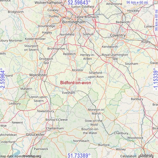
Bidford-on-avon GPS coordinates[2]
52° 10' 2.1" North, 1° 51' 23.472" West
| Map corner | latitude | longitude |
|---|---|---|
| Upper-left | 52.59643°, | -2.55964° |
| Center: | 52.16725°, | -1.85652° |
| Lower-right: | 51.73389°, | -1.15339° |
| Map W x H: | 95.9×95.9 km | = 59.6×59.6mi |
| max Lat: | 60.39635° ⇑57.3% North |
| Bidford-on-avon: | 52.16725° |
| min Lat: | ⇓42.7% South 34.60088° |
| min Long | Bidford-on-avon | max Long |
| -7.64133° | -1.85652° | 32.95536° |
| W 47.9%⇐ | ⇒52.1% E |
Elevation
Elevation of Bidford-on-avon is 39 m = 128 ft, and this is 33.9 m = 111 ft below average elevation for this country.
| Max E: |
515 m = 1690 ft | 65.5% |
| Avg. | 72.9 m = 239 ft | |
| Bidford-on-avon | 39 m = 128 ft | |
Min E: |
-30 m = -98 ft | 34.5% |
See also: United Kingdom elevation on elevation.city.
Geographical zone
Bidford-on-avon is located in North temperate zone (between Tropic of Cancer and the Arctic Circle). Distance of this North polar circle is 1600.7 km =994.6 mi to North.| Distance of | km | miles | from Bidford-on-avon |
|---|---|---|---|
| North Pole | 4206.6 | 2613.9 | to North |
| Arctic Circle | 1600.7 | 994.6 | to North |
| Tropic Cancer | 3194.5 | 1985 | to South |
| Equator | 5800.5 | 3604.3 | to South |


Nearby cities:
15 places around Bidford-on-avon: (largest is in red/bold)
• Alcester
5.5 km =3.4 mi,  352°
352°
• Badsey
9.3 km =5.8 mi,  198°
198°
• Bidford-on-Avon
0.3 km =0.2 mi,  322°
322°
• Bishampton
10.9 km =6.8 mi,  266°
266°
• Cleeve Prior
3 km =1.9 mi,  206°
206°
• Evesham
10.4 km =6.5 mi,  217°
217°
• Harvington
5.4 km =3.4 mi,  237°
237°
• Honeybourne
8.2 km =5.1 mi,  167°
167°
• Inkberrow
9.9 km =6.2 mi,  300°
300°
• Mickleton
10.4 km =6.5 mi,  143°
143°
• Pebworth
6.1 km =3.8 mi,  150°
150°
• Salford Priors
2.5 km =1.6 mi,  246°
246°
• South Littleton
6.3 km =3.9 mi, 201°
• Stratford-upon-Avon
10.5 km =6.5 mi,  75°
75°
• Wilmcote
8.6 km =5.3 mi,  46°
46°
Sources, notices
• [Note1] Compared only with cities in United Kingdom existing in our database
• [Src1] Map data: © OpenStreetMap contributors (CC-BY-SA)
• [Src2] Other city data from geonames.org with taken over terms of usage.
• [Src3] Geographical zone / Annual Mean Temperature by Robert A. Rohde @ Wikipedia
