Donnington geodata
Donnington (England) is a populated place; located in United Kingdom in Europe/London (GMT+1) time zone. With population of 4,477 people, there are 1743 cities with bigger population in this country. Compared to other cities in United Kingdom, 63.5% of cities are located further ↑North; 50.5% of cities are located further ←West and 96% of cities have lower elevation than Donnington. Note1
Administrative division(s):
- Level 1: England
- Level 2: Gloucestershire
- Level 3: Cotswold District
- Level 4: Donnington


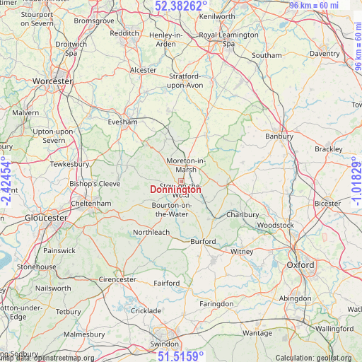
Donnington GPS coordinates[2]
51° 57' 4.86" North, 1° 43' 17.112" West
| Map corner | latitude | longitude |
|---|---|---|
| Upper-left | 52.38262°, | -2.42454° |
| Center: | 51.95135°, | -1.72142° |
| Lower-right: | 51.5159°, | -1.01829° |
| Map W x H: | 96.4×96.4 km | = 59.9×59.9mi |
| max Lat: | 60.39635° ⇑63.5% North |
| Donnington: | 51.95135° |
| min Lat: | ⇓36.5% South 34.60088° |
| min Long | Donnington | max Long |
| -7.64133° | -1.72142° | 32.95536° |
| W 50.5%⇐ | ⇒49.5% E |
Elevation
Elevation of Donnington is 194 m = 636 ft, and this is 121.1 m = 397 ft above average elevation for this country.
| Max E: |
515 m = 1690 ft | 4% |
| Donnington | 194 m 636 ft | |
| Avg. | 72.9 m = 239 ft | |
Min E: |
-30 m = -98 ft | 96% |
See also: United Kingdom elevation on elevation.city.
Geographical zone
Donnington is located in North temperate zone (between Tropic of Cancer and the Arctic Circle). Distance of this North polar circle is 1624.7 km =1009.5 mi to North.| Distance of | km | miles | from Donnington |
|---|---|---|---|
| North Pole | 4230.6 | 2628.8 | to North |
| Arctic Circle | 1624.7 | 1009.5 | to North |
| Tropic Cancer | 3170.5 | 1970.1 | to South |
| Equator | 5776.4 | 3589.3 | to South |


Nearby cities:
15 places around Donnington: (largest is in red/bold)
• Ascott under Wychwood
14.3 km =8.9 mi,  131°
131°
• Bledington
7.4 km =4.6 mi,  135°
135°
• Blockley
7.3 km =4.5 mi,  337°
337°
• Bourton on the Water
7.6 km =4.7 mi,  197°
197°
• Broadway
13.6 km =8.5 mi,  315°
315°
• Chipping Campden
11.6 km =7.2 mi, 340°
• Chipping Norton
12.1 km =7.5 mi,  95°
95°
• Great Rollright
13.5 km =8.4 mi,  78°
78°
• Kingham
7.9 km =4.9 mi,  120°
120°
• Long Compton
10.6 km =6.6 mi,  64°
64°
• Moreton in Marsh
4.4 km =2.7 mi,  16°
16°
• Shipston on Stour
13.7 km =8.5 mi,  27°
27°
• Shipton under Wychwood
13.2 km =8.2 mi, 140°
• Stow on the Wold
2.4 km =1.5 mi,  183°
183°
• Westfield
12.5 km =7.8 mi,  232°
232°
Sources, notices
• [Note1] Compared only with cities in United Kingdom existing in our database
• [Src1] Map data: © OpenStreetMap contributors (CC-BY-SA)
• [Src2] Other city data from geonames.org with taken over terms of usage.
• [Src3] Geographical zone / Annual Mean Temperature by Robert A. Rohde @ Wikipedia
