Doukádes geodata
Doukádes (Ionian Islands) is a populated place; located in Greece in Europe/Athens (GMT+3) time zone. With population of 627 people, there are 1535 cities with bigger population in this country. Compared to other cities in Greece, 62.3% of cities are located further ↓South; 99.7% of cities are located further →East and 69.4% of cities have lower elevation than Doukádes. Note1


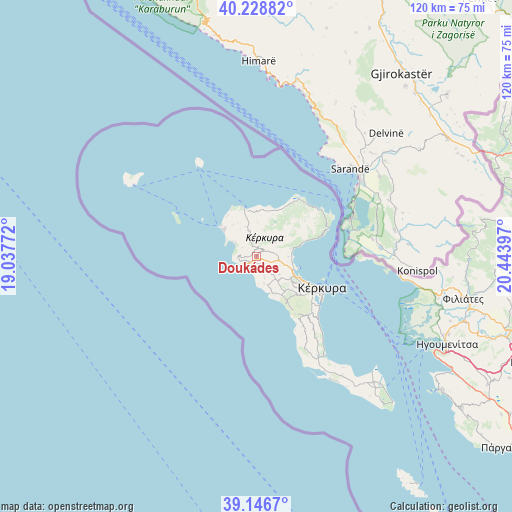
Doukádes GPS coordinates[2]
39° 41' 23.568" North, 19° 44' 27.024" East
| Map corner | latitude | longitude |
|---|---|---|
| Upper-left | 40.22882°, | 19.03772° |
| Center: | 39.68988°, | 19.74084° |
| Lower-right: | 39.1467°, | 20.44397° |
| Map W x H: | 120.3×120.3 km | = 74.8×74.8mi |
| max Lat: | 41.72048° ⇑37.7% North |
| Doukádes: | 39.68988° |
| min Lat: | ⇓62.3% South 34.8346° |
| min Long | Doukádes | max Long |
| 19.40494° | 19.74084° | 29.59361° |
| W 0.3%⇐ | ⇒99.7% E |
Elevation
Elevation of Doukádes is 162 m = 531 ft, and this is 6.9 m = 23 ft below average elevation for this country.
| Max E: |
1439 m = 4721 ft | 30.6% |
| Avg. | 168.9 m = 554 ft | |
| Doukádes | 162 m = 531 ft | |
Min E: |
0 m = 0 ft | 69.4% |
See also: Greece elevation on elevation.city.
Geographical zone
Doukádes is located in North temperate zone (between Tropic of Cancer and the Arctic Circle). Distance of this Northern Tropic circle is 1807.2 km =1122.9 mi to South.| Distance of | km | miles | from Doukádes |
|---|---|---|---|
| North Pole | 5594 | 3475.9 | to North |
| Arctic Circle | 2988.1 | 1856.7 | to North |
| Tropic Cancer | 1807.2 | 1122.9 | to South |
| Equator | 4413.1 | 2742.2 | to South |


Nearby cities:
15 places around Doukádes: (largest is in red/bold)
• Agios Georgis
5.1 km =3.2 mi,  316°
316°
• Giannádes
6.8 km =4.2 mi,  163°
163°
• Gouviá
9.6 km =6 mi,  115°
115°
• Karousádes
10.1 km =6.3 mi,  1°
1°
• Kavvadádes
8.1 km =5 mi, 319°
• Kontokáli
10.8 km =6.7 mi, 118°
• Kyrá Chrysikoú
9.8 km =6.1 mi, 124°
• Káto Agios Márkos
8.1 km =5 mi,  77°
77°
• Káto Korakiána
7.5 km =4.7 mi,  90°
90°
• Liapádes
2.3 km =1.4 mi,  181°
181°
• Límni
9.6 km =6 mi,  107°
107°
• Nýmfes
8.3 km =5.2 mi,  27°
27°
• Spartýlas
9.3 km =5.8 mi,  68°
68°
• Ypsos
8.2 km =5.1 mi, 86°
• Áno Korakiána
4.7 km =2.9 mi, 68°
Sources, notices
• [Note1] Compared only with cities in Greece existing in our database
• [Src1] Map data: © OpenStreetMap contributors (CC-BY-SA)
• [Src2] Other city data from geonames.org with taken over terms of usage.
• [Src3] Geographical zone / Annual Mean Temperature by Robert A. Rohde @ Wikipedia
