Diónysos geodata
Diónysos (Attica) is a populated place; located in Greece in Europe/Athens (GMT+3) time zone. With population of 5,651 people, there are 215 cities with bigger population in this country. Compared to other cities in Greece, 70.1% of cities are located further ↑North; 75.7% of cities are located further ←West and 88.7% of cities have lower elevation than Diónysos. Note1
Administrative division(s):
- Level 1: Attica
- Level 2: Nomarchía Anatolikís Attikís
- Level 3: Dimos Dionysos


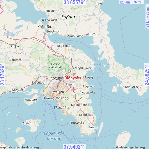
Diónysos GPS coordinates[2]
38° 6' 16.488" North, 23° 52' 45.768" East
| Map corner | latitude | longitude |
|---|---|---|
| Upper-left | 38.65576°, | 23.17626° |
| Center: | 38.10458°, | 23.87938° |
| Lower-right: | 37.54921°, | 24.58251° |
| Map W x H: | 123×123 km | = 76.4×76.4mi |
| max Lat: | 41.72048° ⇑70.1% North |
| Diónysos: | 38.10458° |
| min Lat: | ⇓29.9% South 34.8346° |
| min Long | Diónysos | max Long |
| 19.40494° | 23.87938° | 29.59361° |
| W 75.7%⇐ | ⇒24.3% E |
Elevation
Elevation of Diónysos is 482 m = 1581 ft, and this is 313.1 m = 1027 ft above average elevation for this country.
| Max E: |
1439 m = 4721 ft | 11.3% |
| Diónysos | 482 m 1581 ft | |
| Avg. | 168.9 m = 554 ft | |
Min E: |
0 m = 0 ft | 88.7% |
See also: Greece elevation on elevation.city.
Geographical zone
Diónysos is located in North temperate zone (between Tropic of Cancer and the Arctic Circle). Distance of this Northern Tropic circle is 1630.9 km =1013.4 mi to South.| Distance of | km | miles | from Diónysos |
|---|---|---|---|
| North Pole | 5770.2 | 3585.4 | to North |
| Arctic Circle | 3164.3 | 1966.2 | to North |
| Tropic Cancer | 1630.9 | 1013.4 | to South |
| Equator | 4236.8 | 2632.6 | to South |


Nearby cities:
15 places around Diónysos: (largest is in red/bold)
• Anoixi
3.6 km =2.2 mi,  329°
329°
• Drosiá
2.1 km =1.3 mi,  321°
321°
• Efédron Anagénnisi
2.6 km =1.6 mi,  263°
263°
• Ekáli
3.9 km =2.4 mi,  279°
279°
• Kifisiá
6.9 km =4.3 mi,  240°
240°
• Kryonéri
5.6 km =3.5 mi,  310°
310°
• Melíssia
7.3 km =4.5 mi,  213°
213°
• Néa Erythraía
5.2 km =3.2 mi, 255°
• Néa Pentéli
5.2 km =3.2 mi,  199°
199°
• Pentéli
6.2 km =3.9 mi,  190°
190°
• Rodópoli
1.4 km =0.9 mi,  346°
346°
• Stamáta
2.3 km =1.4 mi,  2°
2°
• Varybóbi
8.4 km =5.2 mi,  287°
287°
• Vraná
6.7 km =4.2 mi,  70°
70°
• Ágios Stéfanos
5.1 km =3.2 mi,  336°
336°
Sources, notices
• [Note1] Compared only with cities in Greece existing in our database
• [Src1] Map data: © OpenStreetMap contributors (CC-BY-SA)
• [Src2] Other city data from geonames.org with taken over terms of usage.
• [Src3] Geographical zone / Annual Mean Temperature by Robert A. Rohde @ Wikipedia
