Epanomí geodata
Epanomí (Central Macedonia) is a populated place; located in Greece in Europe/Athens (GMT+3) time zone. With population of 8,121 people, there are 164 cities with bigger population in this country. Compared to other cities in Greece, 72.5% of cities are located further ↓South; 52.3% of cities are located further ←West and 64.6% of cities have higher elevation than Epanomí. Note1
Administrative division(s):
- Level 1: Central Macedonia
- Level 2: Nomós Thessaloníkis
- Level 3: Dimos Thermaikos


Epanomí GPS coordinates[2]
40° 25' 34.104" North, 22° 55' 40.152" East
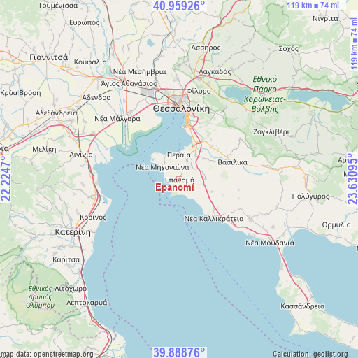
| Map corner | latitude | longitude |
|---|---|---|
| Upper-left | 40.95926°, | 22.2247° |
| Center: | 40.42614°, | 22.92782° |
| Lower-right: | 39.88876°, | 23.63095° |
| Map W x H: | 119×119 km | = 73.9×73.9mi |
| max Lat: | 41.72048° ⇑27.5% North |
| Epanomí: | 40.42614° |
| min Lat: | ⇓72.5% South 34.8346° |
| min Long | Epanomí | max Long |
| 19.40494° | 22.92782° | 29.59361° |
| W 52.3%⇐ | ⇒47.7% E |
Elevation
Elevation of Epanomí is 40 m = 131 ft, and this is 128.9 m = 423 ft below average elevation for this country.
| Max E: |
1439 m = 4721 ft | 64.6% |
| Avg. | 168.9 m = 554 ft | |
| Epanomí | 40 m = 131 ft | |
Min E: |
0 m = 0 ft | 35.4% |
See also: Greece elevation on elevation.city.
Geographical zone
Epanomí is located in North temperate zone (between Tropic of Cancer and the Arctic Circle). Distance of this Northern Tropic circle is 1889 km =1173.8 mi to South.| Distance of | km | miles | from Epanomí |
|---|---|---|---|
| North Pole | 5512.1 | 3425.1 | to North |
| Arctic Circle | 2906.2 | 1805.8 | to North |
| Tropic Cancer | 1889 | 1173.8 | to South |
| Equator | 4495 | 2793.1 | to South |


Nearby cities:
15 places around Epanomí: (largest is in red/bold)
• Agía Paraskeví
11.9 km =7.4 mi,  58°
58°
• Agía Triáda
9.4 km =5.8 mi,  330°
330°
• Angelochórion
11.2 km =7 mi,  314°
314°
• Kardiá
7.3 km =4.5 mi,  49°
49°
• Káto Scholári
8.6 km =5.3 mi,  87°
87°
• Lákkoma
11.5 km =7.1 mi,  109°
109°
• Mesiméri
6.9 km =4.3 mi,  101°
101°
• Néa Irákleia
11.5 km =7.1 mi,  139°
139°
• Néa Kerasiá
7.4 km =4.6 mi,  317°
317°
• Néa Michanióna
7 km =4.3 mi, 306°
• Néo Rýsi
9.3 km =5.8 mi,  33°
33°
• Néoi Epivátes
8.2 km =5.1 mi,  350°
350°
• Peraía
8.1 km =5 mi,  359°
359°
• Plagiári
5.8 km =3.6 mi, 26°
• Trílofos
6 km =3.7 mi,  37°
37°
Sources, notices
• [Note1] Compared only with cities in Greece existing in our database
• [Src1] Map data: © OpenStreetMap contributors (CC-BY-SA)
• [Src2] Other city data from geonames.org with taken over terms of usage.
• [Src3] Geographical zone / Annual Mean Temperature by Robert A. Rohde @ Wikipedia
