Bakar geodata
Bakar (Primorsko-Goranska) is a seat of a second-order administrative division; located in Croatia in Europe/Zagreb (GMT+2) time zone. With population of 1,574 people, there are 281 cities with bigger population in this country. Compared to other cities in Croatia, 59.1% of cities are located further ↑North; 92.6% of cities are located further →East and 83% of cities have higher elevation than Bakar. Note1


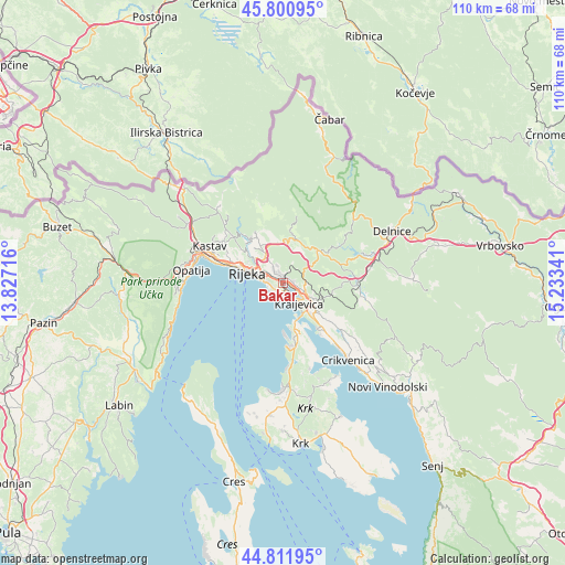
Bakar GPS coordinates[2]
45° 18' 30.996" North, 14° 31' 49.008" East
| Map corner | latitude | longitude |
|---|---|---|
| Upper-left | 45.80095°, | 13.82716° |
| Center: | 45.30861°, | 14.53028° |
| Lower-right: | 44.81195°, | 15.23341° |
| Map W x H: | 110×110 km | = 68.4×68.4mi |
| max Lat: | 46.52694° ⇑59.1% North |
| Bakar: | 45.30861° |
| min Lat: | ⇓40.9% South 42.54972° |
| min Long | Bakar | max Long |
| 13.52389° | 14.53028° | 19.37694° |
| W 7.4%⇐ | ⇒92.6% E |
Elevation
Elevation of Bakar is 82 m = 269 ft, and this is 71.3 m = 234 ft below average elevation for this country.
| Max E: |
827 m = 2713 ft | 83% |
| Avg. | 153.3 m = 503 ft | |
| Bakar | 82 m = 269 ft | |
Min E: |
-1 m = -3 ft | 17% |
See also: Croatia elevation on elevation.city.
Geographical zone
Bakar is located in North temperate zone (between Tropic of Cancer and the Arctic Circle). Distance of this North polar circle is 2363.3 km =1468.5 mi to North.| Distance of | km | miles | from Bakar |
|---|---|---|---|
| North Pole | 4969.2 | 3087.7 | to North |
| Arctic Circle | 2363.3 | 1468.5 | to North |
| Tropic Cancer | 2431.9 | 1511.1 | to South |
| Equator | 5037.8 | 3130.3 | to South |


Nearby cities:
15 places around Bakar: (largest is in red/bold)
• Buzdohanj
5.2 km =3.2 mi,  321°
321°
• Cernik
4.5 km =2.8 mi,  330°
330°
• Dražice
10.3 km =6.4 mi, 332°
• Drenova
9.1 km =5.7 mi,  300°
300°
• Hreljin
6.1 km =3.8 mi,  118°
118°
• Kostrena
2.1 km =1.3 mi,  246°
246°
• Kraljevica
4.9 km =3 mi,  142°
142°
• Krasica
2 km =1.2 mi,  86°
86°
• Kukuljanovo
2 km =1.2 mi,  21°
21°
• Podhum
9.6 km =6 mi,  335°
335°
• Praputnjak
3.6 km =2.2 mi,  107°
107°
• Rijeka
7.2 km =4.5 mi,  286°
286°
• Čavle
6 km =3.7 mi, 323°
• Škrljevo
1.3 km =0.8 mi,  8°
8°
• Šmrika
8.6 km =5.3 mi, 139°
Sources, notices
• [Note1] Compared only with cities in Croatia existing in our database
• [Src1] Map data: © OpenStreetMap contributors (CC-BY-SA)
• [Src2] Other city data from geonames.org with taken over terms of usage.
• [Src3] Geographical zone / Annual Mean Temperature by Robert A. Rohde @ Wikipedia
