Tumpukrenteng geodata
Tumpukrenteng (East Java) is a seat of a fourth-order administrative division; located in Indonesia in Asia/Jakarta (GMT+7) time zone. In our database, there are 407 cities with bigger population. Compared to other cities in Indonesia, 67.3% of cities are located further ↑North; 56.9% of cities are located further ←West and 80.2% of cities have lower elevation than Tumpukrenteng. Note1


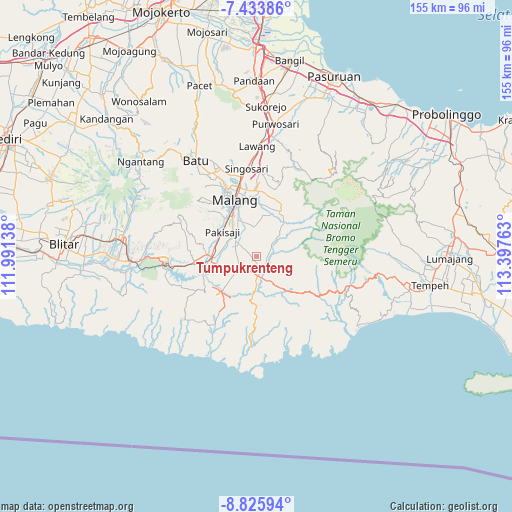
Tumpukrenteng GPS coordinates[2]
8° 7' 49.8" South, 112° 41' 40.2" East
| Map corner | latitude | longitude |
|---|---|---|
| Upper-left | -7.43386°, | 111.99138° |
| Center: | -8.1305°, | 112.6945° |
| Lower-right: | -8.82594°, | 113.39763° |
| Map W x H: | 154.8×154.8 km | = 96.2×96.2mi |
| max Lat: | 5.88969° ⇑67.3% North |
| Tumpukrenteng: | -8.1305° |
| min Lat: | ⇓32.7% South -10.934° |
| min Long | Tumpukrenteng | max Long |
| 95.1345° | 112.6945° | 140.9419° |
| W 56.9%⇐ | ⇒43.1% E |
Elevation
Elevation of Tumpukrenteng is 434 m = 1424 ft, and this is 204.3 m = 670 ft above average elevation for this country.
| Max E: |
3185 m = 10449 ft | 19.8% |
| Tumpukrenteng | 434 m 1424 ft | |
| Avg. | 229.7 m = 754 ft | |
Min E: |
-1 m = -3 ft | 80.2% |
See also: Indonesia elevation on elevation.city.
Geographical zone
Tumpukrenteng is located in South Torrid zone (between Equator and Tropic of Capricorn). Distance of Equator is 904 km =561.7 mi to North.| Distance of | km | miles | from Tumpukrenteng |
|---|---|---|---|
| Equator | 904 | 561.7 | to North |
| Tropic Capricorn | 1701.9 | 1057.5 | to South |
| Antarctic Circle | 6497.1 | 4037.1 | to South |
| South Pole | 9103 | 5656.3 | to South |


Nearby cities:
15 places around Tumpukrenteng: (largest is in red/bold)
• Bakalan
4.5 km =2.8 mi,  301°
301°
• Codo
3.1 km =1.9 mi,  86°
86°
• Jeru
4 km =2.5 mi,  211°
211°
• Kasri
3 km =1.9 mi,  321°
321°
• Kedok
2 km =1.2 mi,  178°
178°
• Kidangbang
4.1 km =2.5 mi,  16°
16°
• Napel
3 km =1.9 mi,  35°
35°
• Pagedangan
3.9 km =2.4 mi,  144°
144°
• Pringu
4.1 km =2.5 mi,  344°
344°
• Sananrejo
3.3 km =2.1 mi,  128°
128°
• Sudimoro
2.5 km =1.6 mi,  287°
287°
• Sukoanyar
4.3 km =2.7 mi,  33°
33°
• Talang Suko
1.4 km =0.9 mi,  216°
216°
• Turen
4.8 km =3 mi,  191°
191°
• Urek-urek
3.6 km =2.2 mi,  249°
249°
Sources, notices
• [Note1] Compared only with cities in Indonesia existing in our database
• [Src1] Map data: © OpenStreetMap contributors (CC-BY-SA)
• [Src2] Other city data from geonames.org with taken over terms of usage.
• [Src3] Geographical zone / Annual Mean Temperature by Robert A. Rohde @ Wikipedia
