Pompongan geodata
Pompongan (East Java) is a seat of a fourth-order administrative division; located in Indonesia in Asia/Jakarta (GMT+7) time zone. In our database, there are 407 cities with bigger population. Compared to other cities in Indonesia, 61.9% of cities are located further ↓South; 54.6% of cities are located further ←West and 97.2% of cities have higher elevation than Pompongan. Note1


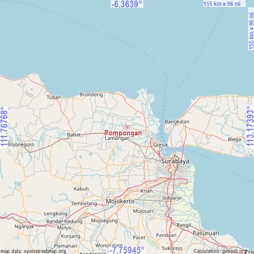
Pompongan GPS coordinates[2]
7° 3' 43.92" South, 112° 28' 14.88" East
| Map corner | latitude | longitude |
|---|---|---|
| Upper-left | -6.3639°, | 111.76768° |
| Center: | -7.0622°, | 112.4708° |
| Lower-right: | -7.75945°, | 113.17393° |
| Map W x H: | 155.2×155.2 km | = 96.4×96.4mi |
| max Lat: | 5.88969° ⇑38.1% North |
| Pompongan: | -7.0622° |
| min Lat: | ⇓61.9% South -10.934° |
| min Long | Pompongan | max Long |
| 95.1345° | 112.4708° | 140.9419° |
| W 54.6%⇐ | ⇒45.4% E |
Elevation
Elevation of Pompongan is 6 m = 20 ft, and this is 223.7 m = 734 ft below average elevation for this country.
| Max E: |
3185 m = 10449 ft | 97.2% |
| Avg. | 229.7 m = 754 ft | |
| Pompongan | 6 m = 20 ft | |
Min E: |
-1 m = -3 ft | 2.8% |
See also: Indonesia elevation on elevation.city.
Geographical zone
Pompongan is located in South Torrid zone (between Equator and Tropic of Capricorn). Distance of Equator is 785.2 km =487.9 mi to North.| Distance of | km | miles | from Pompongan |
|---|---|---|---|
| Equator | 785.2 | 487.9 | to North |
| Tropic Capricorn | 1820.7 | 1131.3 | to South |
| Antarctic Circle | 6615.9 | 4110.9 | to South |
| South Pole | 9221.8 | 5730.2 | to South |


Nearby cities:
15 places around Pompongan: (largest is in red/bold)
• Baturono
1.9 km =1.2 mi,  18°
18°
• Blawi
2 km =1.2 mi,  312°
312°
• Bucu Kidul
1.8 km =1.1 mi,  150°
150°
• Bucu Lor
1.5 km =0.9 mi,  139°
139°
• Calan
1.7 km =1.1 mi,  336°
336°
• Dagangan
3.4 km =2.1 mi,  199°
199°
• Duni
0.9 km =0.6 mi, 200°
• Kebon
2.5 km =1.6 mi,  2°
2°
• Kebon Tengah
3.5 km =2.2 mi,  187°
187°
• Ladan
3.3 km =2.1 mi,  266°
266°
• Magok
2.8 km =1.7 mi, 341°
• Prioso Barat
2.4 km =1.5 mi,  53°
53°
• Rawaglagah
3.3 km =2.1 mi,  238°
238°
• Sampangan
1.7 km =1.1 mi,  230°
230°
• Sudangan
3.6 km =2.2 mi,  130°
130°
Sources, notices
• [Note1] Compared only with cities in Indonesia existing in our database
• [Src1] Map data: © OpenStreetMap contributors (CC-BY-SA)
• [Src2] Other city data from geonames.org with taken over terms of usage.
• [Src3] Geographical zone / Annual Mean Temperature by Robert A. Rohde @ Wikipedia
