Banjar Gunungbau geodata
Banjar Gunungbau (Bali) is a seat of a fourth-order administrative division; located in Indonesia in Asia/Makassar (GMT+8) time zone. In our database, there are 407 cities with bigger population. Compared to other cities in Indonesia, 74.7% of cities are located further ↑North; 73.4% of cities are located further ←West and 98.8% of cities have lower elevation than Banjar Gunungbau. Note1


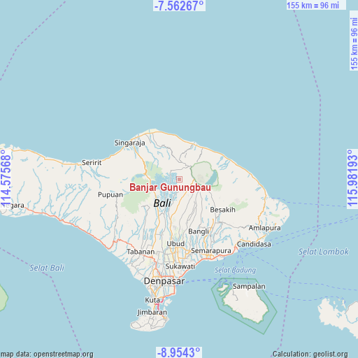
Banjar Gunungbau GPS coordinates[2]
8° 15' 32.76" South, 115° 16' 43.68" East
| Map corner | latitude | longitude |
|---|---|---|
| Upper-left | -7.56267°, | 114.57568° |
| Center: | -8.2591°, | 115.2788° |
| Lower-right: | -8.9543°, | 115.98193° |
| Map W x H: | 154.7×154.7 km | = 96.1×96.1mi |
| max Lat: | 5.88969° ⇑74.7% North |
| Banjar Gunungbau: | -8.2591° |
| min Lat: | ⇓25.3% South -10.934° |
| min Long | Banjar Gunungba | max Long |
| 95.1345° | 115.2788° | 140.9419° |
| W 73.4%⇐ | ⇒26.6% E |
Elevation
Elevation of Banjar Gunungbau is 1180 m = 3871 ft, and this is 950.3 m = 3118 ft above average elevation for this country.
| Max E: |
3185 m = 10449 ft | 1.2% |
| Banjar Gunungbau | 1180 m 3871 ft | |
| Avg. | 229.7 m = 754 ft | |
Min E: |
-1 m = -3 ft | 98.8% |
See also: Indonesia elevation on elevation.city.
Geographical zone
Banjar Gunungbau is located in South Torrid zone (between Equator and Tropic of Capricorn). Distance of Equator is 918.3 km =570.6 mi to North.| Distance of | km | miles | from Banjar Gunungbau |
|---|---|---|---|
| Equator | 918.3 | 570.6 | to North |
| Tropic Capricorn | 1687.6 | 1048.6 | to South |
| Antarctic Circle | 6482.8 | 4028.2 | to South |
| South Pole | 9088.7 | 5647.5 | to South |


Nearby cities:
15 places around Banjar Gunungbau: (largest is in red/bold)
• Banjar Bayungcerik
4.3 km =2.7 mi,  165°
165°
• Banjar Belancan
4.1 km =2.5 mi,  125°
125°
• Banjar Belanga
1.6 km =1 mi,  310°
310°
• Banjar Belok
5 km =3.1 mi,  233°
233°
• Banjar Binyan
2.2 km =1.4 mi, 226°
• Banjar Bunutin
5 km =3.1 mi,  200°
200°
• Banjar Katung
6.4 km =4 mi,  153°
153°
• Banjar Langgahan Kangin
6.2 km =3.9 mi,  187°
187°
• Banjar Lembean
3.6 km =2.2 mi,  179°
179°
• Banjar Mangguh
5.7 km =3.5 mi,  162°
162°
• Banjar Manikliyu
2.4 km =1.5 mi, 157°
• Banjar Mengani
4.1 km =2.5 mi,  220°
220°
• Banjar Tandangbuanasari
5.7 km =3.5 mi,  80°
80°
• Banjar Ulian
2 km =1.2 mi, 198°
• Batur
5.9 km =3.7 mi, 83°
Sources, notices
• [Note1] Compared only with cities in Indonesia existing in our database
• [Src1] Map data: © OpenStreetMap contributors (CC-BY-SA)
• [Src2] Other city data from geonames.org with taken over terms of usage.
• [Src3] Geographical zone / Annual Mean Temperature by Robert A. Rohde @ Wikipedia
