Rejasa Kaja geodata
Rejasa Kaja (Bali) is a seat of a fourth-order administrative division; located in Indonesia in Asia/Makassar (GMT+8) time zone. In our database, there are 407 cities with bigger population. Compared to other cities in Indonesia, 82.1% of cities are located further ↑North; 71.7% of cities are located further ←West and 69.3% of cities have lower elevation than Rejasa Kaja. Note1


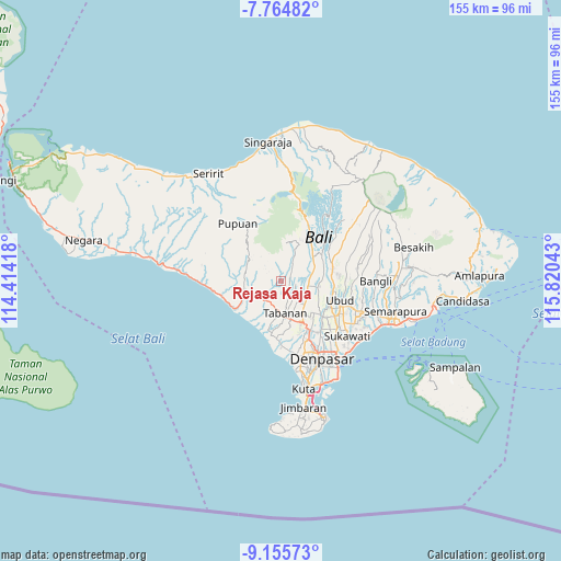
Rejasa Kaja GPS coordinates[2]
8° 27' 39.24" South, 115° 7' 2.28" East
| Map corner | latitude | longitude |
|---|---|---|
| Upper-left | -7.76482°, | 114.41418° |
| Center: | -8.4609°, | 115.1173° |
| Lower-right: | -9.15573°, | 115.82043° |
| Map W x H: | 154.7×154.7 km | = 96.1×96.1mi |
| max Lat: | 5.88969° ⇑82.1% North |
| Rejasa Kaja: | -8.4609° |
| min Lat: | ⇓17.9% South -10.934° |
| min Long | Rejasa Kaja | max Long |
| 95.1345° | 115.1173° | 140.9419° |
| W 71.7%⇐ | ⇒28.3% E |
Elevation
Elevation of Rejasa Kaja is 283 m = 928 ft, and this is 53.3 m = 175 ft above average elevation for this country.
| Max E: |
3185 m = 10449 ft | 30.7% |
| Rejasa Kaja | 283 m 928 ft | |
| Avg. | 229.7 m = 754 ft | |
Min E: |
-1 m = -3 ft | 69.3% |
See also: Indonesia elevation on elevation.city.
Geographical zone
Rejasa Kaja is located in South Torrid zone (between Equator and Tropic of Capricorn). Distance of Equator is 940.8 km =584.6 mi to North.| Distance of | km | miles | from Rejasa Kaja |
|---|---|---|---|
| Equator | 940.8 | 584.6 | to North |
| Tropic Capricorn | 1665.2 | 1034.7 | to South |
| Antarctic Circle | 6460.4 | 4014.3 | to South |
| South Pole | 9066.3 | 5633.5 | to South |


Nearby cities:
15 places around Rejasa Kaja: (largest is in red/bold)
• Apityeh
5.1 km =3.2 mi,  280°
280°
• Baleagung
1.9 km =1.2 mi,  60°
60°
• Buahan Tengah
5.2 km =3.2 mi,  136°
136°
• Buruan Tengah
2.4 km =1.5 mi,  82°
82°
• Carik
5.1 km =3.2 mi,  240°
240°
• Dalangdesa
4.6 km =2.9 mi,  299°
299°
• Delodpeken
4.6 km =2.9 mi,  219°
219°
• Denuma
5.1 km =3.2 mi,  6°
6°
• Kesiutkawan Kaja
2.3 km =1.4 mi,  203°
203°
• Penatahan Kaja
2.9 km =1.8 mi,  18°
18°
• Pohgending Kangin
4.5 km =2.8 mi,  43°
43°
• Pohgending Kawan
3.9 km =2.4 mi,  45°
45°
• Riang Tengah
3.7 km =2.3 mi,  168°
168°
• Tunjuk Selatan
4.1 km =2.5 mi,  113°
113°
• Wanasari Baleran
3.3 km =2.1 mi, 144°
Sources, notices
• [Note1] Compared only with cities in Indonesia existing in our database
• [Src1] Map data: © OpenStreetMap contributors (CC-BY-SA)
• [Src2] Other city data from geonames.org with taken over terms of usage.
• [Src3] Geographical zone / Annual Mean Temperature by Robert A. Rohde @ Wikipedia
