Gunungmalang Satu geodata
Gunungmalang Satu (East Java) is a seat of a fourth-order administrative division; located in Indonesia in Asia/Jakarta (GMT+7) time zone. In our database, there are 407 cities with bigger population. Compared to other cities in Indonesia, 65.5% of cities are located further ↑North; 66.6% of cities are located further ←West and 81.6% of cities have lower elevation than Gunungmalang Satu. Note1


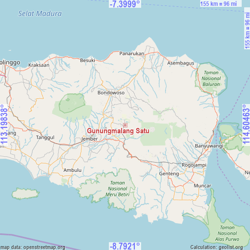
Gunungmalang Satu GPS coordinates[2]
8° 5' 47.76" South, 113° 54' 5.4" East
| Map corner | latitude | longitude |
|---|---|---|
| Upper-left | -7.3999°, | 113.19838° |
| Center: | -8.0966°, | 113.9015° |
| Lower-right: | -8.7921°, | 114.60463° |
| Map W x H: | 154.8×154.8 km | = 96.2×96.2mi |
| max Lat: | 5.88969° ⇑65.5% North |
| Gunungmalang Satu: | -8.0966° |
| min Lat: | ⇓34.5% South -10.934° |
| min Long | Gunungmalang Sa | max Long |
| 95.1345° | 113.9015° | 140.9419° |
| W 66.6%⇐ | ⇒33.4% E |
Elevation
Elevation of Gunungmalang Satu is 456 m = 1496 ft, and this is 226.3 m = 742 ft above average elevation for this country.
| Max E: |
3185 m = 10449 ft | 18.4% |
| Gunungmalang Satu | 456 m 1496 ft | |
| Avg. | 229.7 m = 754 ft | |
Min E: |
-1 m = -3 ft | 81.6% |
See also: Indonesia elevation on elevation.city.
Geographical zone
Gunungmalang Satu is located in South Torrid zone (between Equator and Tropic of Capricorn). Distance of Equator is 900.3 km =559.4 mi to North.| Distance of | km | miles | from Gunungmalang Satu |
|---|---|---|---|
| Equator | 900.3 | 559.4 | to North |
| Tropic Capricorn | 1705.7 | 1059.9 | to South |
| Antarctic Circle | 6500.9 | 4039.5 | to South |
| South Pole | 9106.8 | 5658.7 | to South |


Nearby cities:
15 places around Gunungmalang Satu: (largest is in red/bold)
• Biting
5.5 km =3.4 mi,  298°
298°
• Cumedak
1 km =0.6 mi,  246°
246°
• Jambearum
5.8 km =3.6 mi,  25°
25°
• Karangsumber
3.1 km =1.9 mi, 295°
• Krajan Ledokombo
5.1 km =3.2 mi,  239°
239°
• Krajan Sumberanget
6.6 km =4.1 mi, 254°
• Krajan Sumberdanti
6.5 km =4 mi,  319°
319°
• Ledokombo
5.1 km =3.2 mi,  214°
214°
• Plereyan
6.3 km =3.9 mi,  328°
328°
• Rowosari
3.8 km =2.4 mi,  48°
48°
• Slateng Dua
2 km =1.2 mi, 212°
• Sukosari
6.8 km =4.2 mi,  282°
282°
• Sumberbulus Dua
5 km =3.1 mi,  185°
185°
• Sumberjambe
3 km =1.9 mi,  357°
357°
• Sumberpakem
5.6 km =3.5 mi, 323°
Sources, notices
• [Note1] Compared only with cities in Indonesia existing in our database
• [Src1] Map data: © OpenStreetMap contributors (CC-BY-SA)
• [Src2] Other city data from geonames.org with taken over terms of usage.
• [Src3] Geographical zone / Annual Mean Temperature by Robert A. Rohde @ Wikipedia
