Kebunjeruk geodata
Kebunjeruk (East Java) is a seat of a fourth-order administrative division; located in Indonesia in Asia/Jakarta (GMT+7) time zone. In our database, there are 407 cities with bigger population. Compared to other cities in Indonesia, 71.5% of cities are located further ↑North; 69.6% of cities are located further ←West and 81.9% of cities have higher elevation than Kebunjeruk. Note1


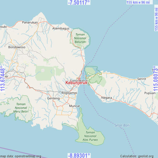
Kebunjeruk GPS coordinates[2]
8° 11' 51.72" South, 114° 22' 39.36" East
| Map corner | latitude | longitude |
|---|---|---|
| Upper-left | -7.50117°, | 113.67448° |
| Center: | -8.1977°, | 114.3776° |
| Lower-right: | -8.89301°, | 115.08073° |
| Map W x H: | 154.8×154.8 km | = 96.2×96.2mi |
| max Lat: | 5.88969° ⇑71.5% North |
| Kebunjeruk: | -8.1977° |
| min Lat: | ⇓28.5% South -10.934° |
| min Long | Kebunjeruk | max Long |
| 95.1345° | 114.3776° | 140.9419° |
| W 69.6%⇐ | ⇒30.4% E |
Elevation
Elevation of Kebunjeruk is 17 m = 56 ft, and this is 212.7 m = 698 ft below average elevation for this country.
| Max E: |
3185 m = 10449 ft | 81.9% |
| Avg. | 229.7 m = 754 ft | |
| Kebunjeruk | 17 m = 56 ft | |
Min E: |
-1 m = -3 ft | 18.1% |
See also: Indonesia elevation on elevation.city.
Geographical zone
Kebunjeruk is located in South Torrid zone (between Equator and Tropic of Capricorn). Distance of Equator is 911.5 km =566.4 mi to North.| Distance of | km | miles | from Kebunjeruk |
|---|---|---|---|
| Equator | 911.5 | 566.4 | to North |
| Tropic Capricorn | 1694.4 | 1052.9 | to South |
| Antarctic Circle | 6489.7 | 4032.5 | to South |
| South Pole | 9095.6 | 5651.7 | to South |


Nearby cities:
15 places around Kebunjeruk: (largest is in red/bold)
• Cungking
3.3 km =2.1 mi,  230°
230°
• Gaplak
4.1 km =2.5 mi, 234°
• Grobokan
0.8 km =0.5 mi,  167°
167°
• Kaliasin
2.5 km =1.6 mi,  179°
179°
• Kalipuro
3.8 km =2.4 mi,  327°
327°
• Klatakan
2.5 km =1.6 mi,  14°
14°
• Krajan
0.9 km =0.6 mi,  216°
216°
• Krajan
2.1 km =1.3 mi,  264°
264°
• Krajan
2.5 km =1.6 mi,  196°
196°
• Krajan Satu
2.6 km =1.6 mi,  245°
245°
• Krajan Selatan
2.9 km =1.8 mi, 196°
• Sritanjung
1.1 km =0.7 mi, 182°
• Tirtopuro
3 km =1.9 mi,  310°
310°
• Ujung
1.8 km =1.1 mi, 165°
• Wirodayan
1.9 km =1.2 mi,  205°
205°
Sources, notices
• [Note1] Compared only with cities in Indonesia existing in our database
• [Src1] Map data: © OpenStreetMap contributors (CC-BY-SA)
• [Src2] Other city data from geonames.org with taken over terms of usage.
• [Src3] Geographical zone / Annual Mean Temperature by Robert A. Rohde @ Wikipedia
