Gunungempuk geodata
Gunungempuk (West Java) is a seat of a fourth-order administrative division; located in Indonesia in Asia/Jakarta (GMT+7) time zone. In our database, there are 407 cities with bigger population. Compared to other cities in Indonesia, 71.9% of cities are located further ↓South; 87.7% of cities are located further →East and 83.1% of cities have lower elevation than Gunungempuk. Note1


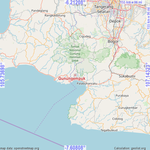
Gunungempuk GPS coordinates[2]
6° 54' 38.16" South, 106° 26' 24.36" East
| Map corner | latitude | longitude |
|---|---|---|
| Upper-left | -6.21208°, | 105.73698° |
| Center: | -6.9106°, | 106.4401° |
| Lower-right: | -7.60808°, | 107.14323° |
| Map W x H: | 155.2×155.2 km | = 96.4×96.4mi |
| max Lat: | 5.88969° ⇑28.1% North |
| Gunungempuk: | -6.9106° |
| min Lat: | ⇓71.9% South -10.934° |
| min Long | Gunungempuk | max Long |
| 95.1345° | 106.4401° | 140.9419° |
| W 12.3%⇐ | ⇒87.7% E |
Elevation
Elevation of Gunungempuk is 481 m = 1578 ft, and this is 251.3 m = 824 ft above average elevation for this country.
| Max E: |
3185 m = 10449 ft | 16.9% |
| Gunungempuk | 481 m 1578 ft | |
| Avg. | 229.7 m = 754 ft | |
Min E: |
-1 m = -3 ft | 83.1% |
See also: Indonesia elevation on elevation.city.
Geographical zone
Gunungempuk is located in South Torrid zone (between Equator and Tropic of Capricorn). Distance of Equator is 768.4 km =477.5 mi to North.| Distance of | km | miles | from Gunungempuk |
|---|---|---|---|
| Equator | 768.4 | 477.5 | to North |
| Tropic Capricorn | 1837.5 | 1141.8 | to South |
| Antarctic Circle | 6632.8 | 4121.4 | to South |
| South Pole | 9238.7 | 5740.7 | to South |


Nearby cities:
15 places around Gunungempuk: (largest is in red/bold)
• Bantarjati
8.8 km =5.5 mi,  219°
219°
• Caringin
4.5 km =2.8 mi,  259°
259°
• Cibangban Girang
5.3 km =3.3 mi,  194°
194°
• Cijapar
2.5 km =1.6 mi,  330°
330°
• Cijengkol
9.2 km =5.7 mi,  270°
270°
• Cikadu
9.9 km =6.2 mi,  348°
348°
• Cikamunding
6 km =3.7 mi, 274°
• Cimaja
7 km =4.3 mi,  134°
134°
• Cinangka
6.4 km =4 mi,  314°
314°
• Cisolok
4.3 km =2.7 mi,  165°
165°
• Karangpapak
6.5 km =4 mi,  147°
147°
• Nagrak
3.2 km =2 mi,  58°
58°
• Pasirbungur
7 km =4.3 mi,  250°
250°
• Sirnaresmi
8.2 km =5.1 mi,  7°
7°
• Tugu
4 km =2.5 mi, 169°
Sources, notices
• [Note1] Compared only with cities in Indonesia existing in our database
• [Src1] Map data: © OpenStreetMap contributors (CC-BY-SA)
• [Src2] Other city data from geonames.org with taken over terms of usage.
• [Src3] Geographical zone / Annual Mean Temperature by Robert A. Rohde @ Wikipedia
