Sorongan geodata
Sorongan (Banten) is a seat of a fourth-order administrative division; located in Indonesia in Asia/Jakarta (GMT+7) time zone. In our database, there are 407 cities with bigger population. Compared to other cities in Indonesia, 77.9% of cities are located further ↓South; 93.8% of cities are located further →East and 68.4% of cities have higher elevation than Sorongan. Note1


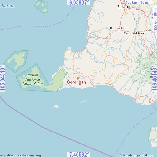
Sorongan GPS coordinates[2]
6° 45' 29.16" South, 105° 44' 53.88" East
| Map corner | latitude | longitude |
|---|---|---|
| Upper-left | -6.05937°, | 105.04518° |
| Center: | -6.7581°, | 105.7483° |
| Lower-right: | -7.45582°, | 106.45143° |
| Map W x H: | 155.3×155.3 km | = 96.5×96.5mi |
| max Lat: | 5.88969° ⇑22.1% North |
| Sorongan: | -6.7581° |
| min Lat: | ⇓77.9% South -10.934° |
| min Long | Sorongan | max Long |
| 95.1345° | 105.7483° | 140.9419° |
| W 6.2%⇐ | ⇒93.8% E |
Elevation
Elevation of Sorongan is 35 m = 115 ft, and this is 194.7 m = 639 ft below average elevation for this country.
| Max E: |
3185 m = 10449 ft | 68.4% |
| Avg. | 229.7 m = 754 ft | |
| Sorongan | 35 m = 115 ft | |
Min E: |
-1 m = -3 ft | 31.6% |
See also: Indonesia elevation on elevation.city.
Geographical zone
Sorongan is located in South Torrid zone (between Equator and Tropic of Capricorn). Distance of Equator is 751.4 km =466.9 mi to North.| Distance of | km | miles | from Sorongan |
|---|---|---|---|
| Equator | 751.4 | 466.9 | to North |
| Tropic Capricorn | 1854.5 | 1152.3 | to South |
| Antarctic Circle | 6649.7 | 4131.9 | to South |
| South Pole | 9255.6 | 5751.2 | to South |


Nearby cities:
15 places around Sorongan: (largest is in red/bold)
• Babakancibaliung
4.7 km =2.9 mi,  344°
344°
• Bungurdua
6 km =3.7 mi,  36°
36°
• Cibaliung
6.9 km =4.3 mi,  328°
328°
• Cicadas
5.9 km =3.7 mi,  90°
90°
• Cihaur
4.9 km =3 mi,  236°
236°
• Cikadu
5.4 km =3.4 mi,  285°
285°
• Cikiruh
3.3 km =2.1 mi, 238°
• Cinyurup
6.3 km =3.9 mi,  250°
250°
• Curug
1.8 km =1.1 mi,  102°
102°
• Dahu Satu
6.3 km =3.9 mi,  68°
68°
• Karamat
4.4 km =2.7 mi,  222°
222°
• Rancasadang
7.5 km =4.7 mi,  272°
272°
• Sudimanik
2.3 km =1.4 mi,  284°
284°
• Sukajadi
6.7 km =4.2 mi,  316°
316°
• Sukapura
3.1 km =1.9 mi,  258°
258°
Sources, notices
• [Note1] Compared only with cities in Indonesia existing in our database
• [Src1] Map data: © OpenStreetMap contributors (CC-BY-SA)
• [Src2] Other city data from geonames.org with taken over terms of usage.
• [Src3] Geographical zone / Annual Mean Temperature by Robert A. Rohde @ Wikipedia
