Cibungur geodata
Cibungur (West Java) is a seat of a fourth-order administrative division; located in Indonesia in Asia/Jakarta (GMT+7) time zone. In our database, there are 407 cities with bigger population. Compared to other cities in Indonesia, 52.2% of cities are located further ↑North; 87.3% of cities are located further →East and 62.8% of cities have higher elevation than Cibungur. Note1


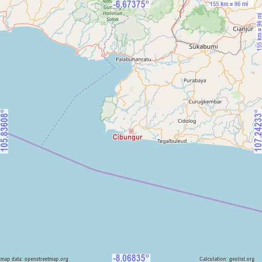
Cibungur GPS coordinates[2]
7° 22' 17.76" South, 106° 32' 21.12" East
| Map corner | latitude | longitude |
|---|---|---|
| Upper-left | -6.67375°, | 105.83608° |
| Center: | -7.3716°, | 106.5392° |
| Lower-right: | -8.06835°, | 107.24233° |
| Map W x H: | 155.1×155.1 km | = 96.4×96.4mi |
| max Lat: | 5.88969° ⇑52.2% North |
| Cibungur: | -7.3716° |
| min Lat: | ⇓47.8% South -10.934° |
| min Long | Cibungur | max Long |
| 95.1345° | 106.5392° | 140.9419° |
| W 12.7%⇐ | ⇒87.3% E |
Elevation
Elevation of Cibungur is 49 m = 161 ft, and this is 180.7 m = 593 ft below average elevation for this country.
| Max E: |
3185 m = 10449 ft | 62.8% |
| Avg. | 229.7 m = 754 ft | |
| Cibungur | 49 m = 161 ft | |
Min E: |
-1 m = -3 ft | 37.2% |
See also: Indonesia elevation on elevation.city.
Geographical zone
Cibungur is located in South Torrid zone (between Equator and Tropic of Capricorn). Distance of Equator is 819.6 km =509.3 mi to North.| Distance of | km | miles | from Cibungur |
|---|---|---|---|
| Equator | 819.6 | 509.3 | to North |
| Tropic Capricorn | 1786.3 | 1110 | to South |
| Antarctic Circle | 6581.5 | 4089.6 | to South |
| South Pole | 9187.4 | 5708.8 | to South |


Nearby cities:
15 places around Cibungur: (largest is in red/bold)
• Ciawangsa
7.4 km =4.6 mi,  10°
10°
• Cikujang
3.9 km =2.4 mi,  69°
69°
• Ciracap
4.9 km =3 mi,  336°
336°
• Citanglar
7.8 km =4.8 mi,  39°
39°
• Citeureup
5.2 km =3.2 mi,  333°
333°
• Karadenan
9.7 km =6 mi, 67°
• Majalaya
8.4 km =5.2 mi,  63°
63°
• Nagrak
4.3 km =2.7 mi,  20°
20°
• Pamoyanan
4.8 km =3 mi, 57°
• Pasirpanjang
7.6 km =4.7 mi,  349°
349°
• Pasirsongket Dua
9.1 km =5.7 mi, 42°
• Pondokaso
1.7 km =1.1 mi, 11°
• Simpang
9.6 km =6 mi,  290°
290°
• Simpenan
3.7 km =2.3 mi,  310°
310°
• Surade
4.1 km =2.5 mi, 36°
Sources, notices
• [Note1] Compared only with cities in Indonesia existing in our database
• [Src1] Map data: © OpenStreetMap contributors (CC-BY-SA)
• [Src2] Other city data from geonames.org with taken over terms of usage.
• [Src3] Geographical zone / Annual Mean Temperature by Robert A. Rohde @ Wikipedia
