Lembur Tengah geodata
Lembur Tengah (West Java) is a seat of a fourth-order administrative division; located in Indonesia in Asia/Jakarta (GMT+7) time zone. In our database, there are 407 cities with bigger population. Compared to other cities in Indonesia, 58.9% of cities are located further ↑North; 83.4% of cities are located further →East and 78.9% of cities have higher elevation than Lembur Tengah. Note1


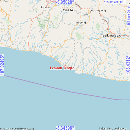
Lembur Tengah GPS coordinates[2]
7° 38' 51.72" South, 107° 43' 41.052" East
| Map corner | latitude | longitude |
|---|---|---|
| Upper-left | -6.95028°, | 107.02495° |
| Center: | -7.6477°, | 107.72807° |
| Lower-right: | -8.34398°, | 108.4312° |
| Map W x H: | 155×155 km | = 96.3×96.3mi |
| max Lat: | 5.88969° ⇑58.9% North |
| Lembur Tengah: | -7.6477° |
| min Lat: | ⇓41.1% South -10.934° |
| min Long | Lembur Tengah | max Long |
| 95.1345° | 107.72807° | 140.9419° |
| W 16.6%⇐ | ⇒83.4% E |
Elevation
Elevation of Lembur Tengah is 20 m = 66 ft, and this is 209.7 m = 688 ft below average elevation for this country.
| Max E: |
3185 m = 10449 ft | 78.9% |
| Avg. | 229.7 m = 754 ft | |
| Lembur Tengah | 20 m = 66 ft | |
Min E: |
-1 m = -3 ft | 21.1% |
See also: Indonesia elevation on elevation.city.
Geographical zone
Lembur Tengah is located in South Torrid zone (between Equator and Tropic of Capricorn). Distance of Equator is 850.3 km =528.4 mi to North.| Distance of | km | miles | from Lembur Tengah |
|---|---|---|---|
| Equator | 850.3 | 528.4 | to North |
| Tropic Capricorn | 1755.6 | 1090.9 | to South |
| Antarctic Circle | 6550.8 | 4070.5 | to South |
| South Pole | 9156.7 | 5689.7 | to South |


Nearby cities:
15 places around Lembur Tengah: (largest is in red/bold)
• Babakan
2.2 km =1.4 mi,  305°
305°
• Bojong
5.8 km =3.6 mi,  8°
8°
• Bunisari
1.7 km =1.1 mi,  270°
270°
• Ciawi
4.3 km =2.7 mi,  115°
115°
• Cibera
7.5 km =4.7 mi,  113°
113°
• Cijambe
7.1 km =4.4 mi,  303°
303°
• Cikelet
6.9 km =4.3 mi, 305°
• Citeureup
2.9 km =1.8 mi, 307°
• Datarpasang
8.5 km =5.3 mi,  35°
35°
• Nangoh
0.7 km =0.4 mi, 305°
• Paas Girang
1.5 km =0.9 mi,  95°
95°
• Pameungpeuk
0.9 km =0.6 mi, 38°
• Pangligaran
7 km =4.3 mi, 41°
• Panyindangan
8.8 km =5.5 mi,  22°
22°
• Puncaksari
1 km =0.6 mi,  29°
29°
Sources, notices
• [Note1] Compared only with cities in Indonesia existing in our database
• [Src1] Map data: © OpenStreetMap contributors (CC-BY-SA)
• [Src2] Other city data from geonames.org with taken over terms of usage.
• [Src3] Geographical zone / Annual Mean Temperature by Robert A. Rohde @ Wikipedia
