Tanjunghurip geodata
Tanjunghurip (West Java) is a seat of a fourth-order administrative division; located in Indonesia in Asia/Jakarta (GMT+7) time zone. In our database, there are 407 cities with bigger population. Compared to other cities in Indonesia, 58% of cities are located further ↓South; 77.5% of cities are located further →East and 83% of cities have lower elevation than Tanjunghurip. Note1


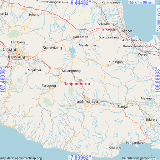
Tanjunghurip GPS coordinates[2]
7° 8' 33" South, 108° 9' 49.32" East
| Map corner | latitude | longitude |
|---|---|---|
| Upper-left | -6.44432°, | 107.46058° |
| Center: | -7.1425°, | 108.1637° |
| Lower-right: | -7.83962°, | 108.86683° |
| Map W x H: | 155.1×155.1 km | = 96.4×96.4mi |
| max Lat: | 5.88969° ⇑42% North |
| Tanjunghurip: | -7.1425° |
| min Lat: | ⇓58% South -10.934° |
| min Long | Tanjunghurip | max Long |
| 95.1345° | 108.1637° | 140.9419° |
| W 22.5%⇐ | ⇒77.5% E |
Elevation
Elevation of Tanjunghurip is 480 m = 1575 ft, and this is 250.3 m = 821 ft above average elevation for this country.
| Max E: |
3185 m = 10449 ft | 17% |
| Tanjunghurip | 480 m 1575 ft | |
| Avg. | 229.7 m = 754 ft | |
Min E: |
-1 m = -3 ft | 83% |
See also: Indonesia elevation on elevation.city.
Geographical zone
Tanjunghurip is located in South Torrid zone (between Equator and Tropic of Capricorn). Distance of Equator is 794.2 km =493.5 mi to North.| Distance of | km | miles | from Tanjunghurip |
|---|---|---|---|
| Equator | 794.2 | 493.5 | to North |
| Tropic Capricorn | 1811.7 | 1125.7 | to South |
| Antarctic Circle | 6607 | 4105.4 | to South |
| South Pole | 9212.9 | 5724.6 | to South |


Nearby cities:
15 places around Tanjunghurip: (largest is in red/bold)
• Asem
2.8 km =1.7 mi,  235°
235°
• Banjarsari
3.1 km =1.9 mi,  107°
107°
• Cijangkar
2.3 km =1.4 mi,  272°
272°
• Cipanjang
2 km =1.2 mi,  164°
164°
• Ciseuti Girang
1.7 km =1.1 mi,  25°
25°
• Kaum Kaler
2.5 km =1.6 mi,  223°
223°
• Kudang
2.7 km =1.7 mi,  208°
208°
• Pakemitan
2.3 km =1.4 mi, 224°
• Pamoyanan
2.2 km =1.4 mi,  330°
330°
• Rancakuya
1.8 km =1.1 mi,  262°
262°
• Sindangharja
3.1 km =1.9 mi,  131°
131°
• Sindangtamu
1.7 km =1.1 mi, 268°
• Sukamaju
2.1 km =1.3 mi,  51°
51°
• Sukapancar
1.9 km =1.2 mi,  88°
88°
• Sukasenang
3.1 km =1.9 mi,  173°
173°
Sources, notices
• [Note1] Compared only with cities in Indonesia existing in our database
• [Src1] Map data: © OpenStreetMap contributors (CC-BY-SA)
• [Src2] Other city data from geonames.org with taken over terms of usage.
• [Src3] Geographical zone / Annual Mean Temperature by Robert A. Rohde @ Wikipedia
