Mekarjaya geodata
Mekarjaya (West Java) is a seat of a fourth-order administrative division; located in Indonesia in Asia/Jakarta (GMT+7) time zone. In our database, there are 407 cities with bigger population. Compared to other cities in Indonesia, 54% of cities are located further ↑North; 73.9% of cities are located further →East and 78.7% of cities have lower elevation than Mekarjaya. Note1


Mekarjaya GPS coordinates[2]
7° 25' 25.32" South, 108° 20' 36.24" East
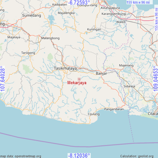
| Map corner | latitude | longitude |
|---|---|---|
| Upper-left | -6.72593°, | 107.64028° |
| Center: | -7.4237°, | 108.3434° |
| Lower-right: | -8.12036°, | 109.04653° |
| Map W x H: | 155×155 km | = 96.3×96.3mi |
| max Lat: | 5.88969° ⇑54% North |
| Mekarjaya: | -7.4237° |
| min Lat: | ⇓46% South -10.934° |
| min Long | Mekarjaya | max Long |
| 95.1345° | 108.3434° | 140.9419° |
| W 26.1%⇐ | ⇒73.9% E |
Elevation
Elevation of Mekarjaya is 409 m = 1342 ft, and this is 179.3 m = 588 ft above average elevation for this country.
| Max E: |
3185 m = 10449 ft | 21.3% |
| Mekarjaya | 409 m 1342 ft | |
| Avg. | 229.7 m = 754 ft | |
Min E: |
-1 m = -3 ft | 78.7% |
See also: Indonesia elevation on elevation.city.
Geographical zone
Mekarjaya is located in South Torrid zone (between Equator and Tropic of Capricorn). Distance of Equator is 825.4 km =512.9 mi to North.| Distance of | km | miles | from Mekarjaya |
|---|---|---|---|
| Equator | 825.4 | 512.9 | to North |
| Tropic Capricorn | 1780.5 | 1106.4 | to South |
| Antarctic Circle | 6575.7 | 4085.9 | to South |
| South Pole | 9181.6 | 5705.2 | to South |


Nearby cities:
15 places around Mekarjaya: (largest is in red/bold)
• Bojongsari
5.2 km =3.2 mi,  313°
313°
• Cidamar
5 km =3.1 mi,  250°
250°
• Cihurip Satu
3 km =1.9 mi,  337°
337°
• Ciriri
2.4 km =1.5 mi,  46°
46°
• Ciwarulang
5.5 km =3.4 mi,  76°
76°
• Darmasari
4.9 km =3 mi,  13°
13°
• Karangpete
5.9 km =3.7 mi,  95°
95°
• Karangsirna
4 km =2.5 mi,  86°
86°
• Panuusan
3.8 km =2.4 mi,  294°
294°
• Pasirmukti
1.9 km =1.2 mi,  183°
183°
• Poponcol
5.1 km =3.2 mi,  265°
265°
• Rahayu
4.1 km =2.5 mi,  21°
21°
• Sindangrasa
5.1 km =3.2 mi, 48°
• Sindangsetra
3.9 km =2.4 mi,  165°
165°
• Sukamaju
4.2 km =2.6 mi,  329°
329°
Sources, notices
• [Note1] Compared only with cities in Indonesia existing in our database
• [Src1] Map data: © OpenStreetMap contributors (CC-BY-SA)
• [Src2] Other city data from geonames.org with taken over terms of usage.
• [Src3] Geographical zone / Annual Mean Temperature by Robert A. Rohde @ Wikipedia
